Near Beckwourth in Plumas County, California — The American West (Pacific Coastal)
Sierra Valley History
Photographed by Barry Swackhamer, June 4, 2013
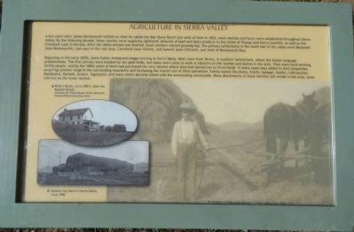
1. Agriculture in Sierra Valley Panel 1
Caption (clockwise from the upper left):Kirby’s Ranch, circa 1890’s; later the Ramelli Ranch. Herbert Huntley with Aonunk (?) horses baling hay, circa 1900. Massive hay stack in Sierra Valley, circa 1900.
Beginning in the early 1870s, Swiss-Italian immigrants began arriving in Sierra Valley. Most came from Tocino, in southern Switzerland, where the Italian language predominates. The first arrivals headed for the gold fields, but many more came to work as laborers on ranches and dairies in the area. They were hard-working, thrifty people, and by the 1880s some of them had purchased the very ranches
this page online
Photographed by Barry Swackhamer, June 4, 2013
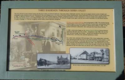
2. Three Railroads Through Sierra Valley Panel 2
Captions (left to right): (background photo) Boca and Loyalton Railroad car near site of Portola, early 1900s. Western Pacific Railroad at Portola Station, 1910. Sierra Valley and Mohawk Railroad at Beckwith Station, circa 1897.
The Boca and Loyalton Railroad was incorporated in 1900. This standard-gauge railroad began at the town of Boca along the Truckee River and extended north to the lumbering center of Loyalton in eastern Sierra Valley. In 1901, it was pushed northwest to Beckwith, then west past the future site of Portola.
In 1905, construction began on the Western Pacific Railroad linking Oakland, California with Salt Lake City in Utah. Completed in late 1909, this was the third railroad through Sierra Valley. Portola was founded at this time as a railroad town, and many new sawmills opened as a result.
For a short time, between 1910 and about 1914, three independent railroads were operating through this area in very close proximity to one another – a very unusual circumstance. In the end, the Western Pacific acquired both of the other railroads and had dismantled them by 1920. Now operated by the Union Pacific Company, the old Western Pacific line has been in use for over 100 years. Remnants of the two older lines can
Photographed by Barry Swackhamer, June 4, 2013
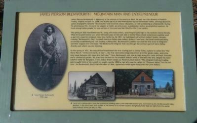
3. James Pierson Beckwourth: Mountain Man and Entrepreneur Panel 3
Captions: (left) James Pierson Beckwourth, 1798 – 1866. (center and right) Local oral tradition has it that the square-log building about a half-mile west of this spot, now known as the Jim Beckwourth Cabin Museum, is the third cabin built by him. It was moved to its current location along Rocky Point Road (at right) from the nearby Kirby/Ramelli Ranch in 1985.
The spring of 1850 found Beckwourth, along with many others, searching for gold high in the northern Sierra Nevada. What he located instead was a low-elevation pass on the east side of the Sierra Nevada which he believed could be used as part of a superior emigrant route to California. By 1851, he had blazed a trail from today’s Sparks, Nevada, crossing “Beckwourth’s Pass” to reach American Valley near today’s Quincy. From here, the route continued along an already established
Photographed by Barry Swackhamer, June 4, 2013
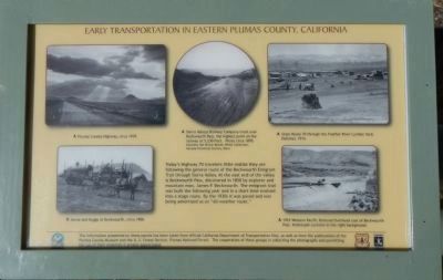
4. Early Transportation in Eastern Plumas County, California Panel 4
Captions (clockwise from the top left): Plumas County Highway, circa 1939. Sierra Valley Railway Company track over Beckwourth Pass, the highest point on the railway at 5,230 feet. Photo circa 1895. State Route 70 through the Feather River Lumber Yard, Delleker, 1914. 1953 Western Pacific Railroad Overhead east of Beckwourth Pass. Hallelujah Junction in the right background. Horse and Buggy at Beckwourth, circa 1900.
By the spring of 1852, Beckwourth had established the first trading post in Sierra Valley, a place he called the “War Horse Ranch.” In his own words, it was “... the first ranch (the emigrant) arrives at in the golden state, and is the only house between this place and Salt Lake.” His place was located on the small hill directly west of the rest area and, despite his more colorful name for the place, it was better known simply as “Beckwourth’s Ranch.” The emigrant trail and trading post brought little of the wealth he sought, and by 1858 he had left what he called his “Pleasant Valley” for the last time. Jim Beckwourth died in late October of 1866, apparently while living with the Crow Indians.
Photographed by Barry Swackhamer, June 4, 2013
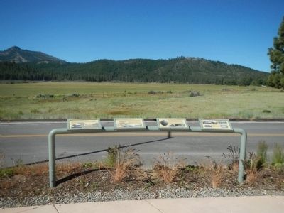
5. Sierra Valley History Marker
The information presented on these panels has been taken from official California Department of Transportation files, as well as from file publications of the Plumas County Museum and the U.S. Forest Service, Plumas National Forest. The cooperation of these groups in collecting the photographs and permitting the use of their materials is greatly appreciated.
Topics and series. This historical marker is listed in these topic lists: Agriculture • Exploration • Railroads & Streetcars • Roads & Vehicles. In addition, it is included in the Beckwourth Trail series list. A significant historical month for this entry is April 1914.
Location. 39° 49.41′ N, 120° 24.814′ W. Marker is near Beckwourth, California, in Plumas County. It can be reached from Feather River Highway, on the left when traveling
Photographed by Barry Swackhamer, June 4, 2013
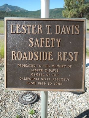
6. Lester T. Davis Safety Roadside Rest
Lester T. Davis
Member of the
California State Assembly
From 1946 to 1952

Regionally, this marker is in the Shasta Cascade and in the Sierra Nevada. It is also in the American Mountain West. Globally, it is in North America, in the Cascade Range, on the Ring of Fire, on the Pacific Rim, in the Western Hemisphere, in the Western World, and in the Anglosphere. Historically, it finds itself in what was once New Spain and also Mexico’s Alta California.
Other nearby markers. At least 8 other markers are within 4 miles of this marker, measured as the crow flies: Step Back In Time (here, next to this marker); Beckwourth Trail – The Road Forks (within shouting distance of this marker); James P. Beckwourth Ranch and Trading Post (within shouting distance of this marker); Jim Beckwourth Trading Post (approx. 0.4 miles away); James P. Beckwourth (approx. 0.4 miles away); Hope Lodge No. 234 F & AM (approx. 1.8 miles away); Beckwourth Trail - Head Waters of Feather River (approx. 2 miles away); Plumas County Honor Roll World War Two and Korea and Vietnam (approx. 3.4 miles away). Touch for a list and map of all markers in Beckwourth.
More about this marker. This marker is located at the Lester T. Davis Safety Roadside Rest Area.
Credits. This page was last revised on June 16, 2016. It was originally submitted on June 21, 2013, by Barry Swackhamer of Brentwood, California. This page has been viewed 1,875 times since then and 111 times this year. Photos: 1, 2, 3, 4, 5, 6. submitted on June 21, 2013, by Barry Swackhamer of Brentwood, California. • Syd Whittle was the editor who published this page.
