
Near Lander in Fremont County, Wyoming — The American West (Mountains)
Beaver Rim and the Wind River Range
Photographed by Duane Hall, May 28, 2013
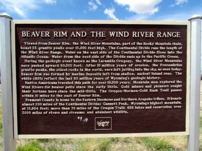
1. Beaver Rim and the Wind River Range Marker
Viewed from Beaver Rim, the Wind River Mountains, part of the Rocky Mountain chain, boast 53 granite peaks over 13,000 feet high. The Continental Divide runs the length of the Wind River Range. Water on the east side of the Continental Divide flows into the Atlantic Ocean. Water from the west side of the Divide ends up in the Pacific Ocean.
During the geologic event known as the Laramide Orogeny, the Wind River Mountains were pushed upward 60,000 feet. After 10 million years of erosion, the Precambrian granite peaks, the oldest rocks in the world, were left jutting into the sky, as seen today. Beaver Rim was formed by marine deposits left from shallow, ancient inland seas. The white cliffs reflect the last 65 million years of Wyoming's geologic history.
Native Americans traveled this path for over 10,000 years. Mountain men explored the Wind Rivers for beaver pelts since the early 1800s. Gold miners and pioneers sought their fortune here since the mid-1800s. The Oregon-Mormon-Gold Rush Trail passes within 10 miles to the east of Beaver Rim.
Fremont County is home to the Eastern Shoshone and Northern Arapaho tribes.
this page online
Topics. This historical marker is listed in these topic lists: Exploration • Indigenous Peoples and Communities • Industry & Commerce • Roads & Vehicles. A significant historical year for this entry is 2000.
Location. 42° 35.118′ N, 108° 17.426′ W. Marker is near Lander, Wyoming, in Fremont County. It can be reached from U.S. 287 12 miles east of Wyoming Highway 28. Marker is located at scenic pullout on north side of US 287. Touch for map. Marker is in this post office area: Lander WY 82520, United States of America. Touch for directions.

Regionally, this marker is in Wind River Country. It is also in the American Mountain West. Globally, it is in North America, the Rocky Mountains, the Western Hemisphere, the Western World, and the Anglosphere.
Other nearby markers. At least 8 other markers are within 10 miles of this marker, measured as the crow flies: Gold Flakes to Yellowcake Historic Mine Trail
Photographed by Duane Hall, May 28, 2013
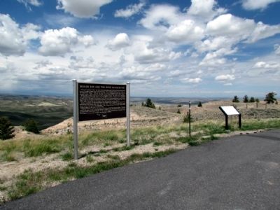
2. Beaver Rim and the Wind River Range Marker
Photographed by Duane Hall, May 28, 2013
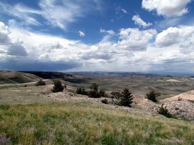
3. View to Northwest from the Marker
Credits. This page was last revised on December 29, 2024. It was originally submitted on July 25, 2013, by Duane Hall of Abilene, Texas. This page has been viewed 3,960 times since then and 237 times this year. Photos: 1, 2, 3. submitted on July 25, 2013, by Duane Hall of Abilene, Texas. • Syd Whittle was the editor who published this page.
