St. Marks in Wakulla County, Florida — The American South (South Atlantic)
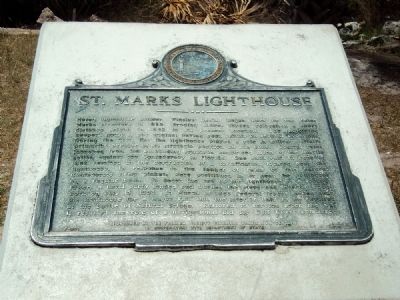
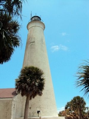
St. Marks Lighthouse
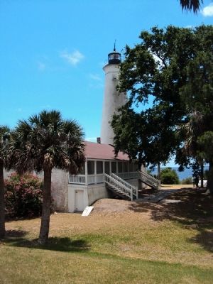
Noted lighthouse builder Winslow Lewis began work on the Saint Marks structure in 1829. Eroding shores forced relocation a short distance inland in 1842 to its present location. The adjoining keeper’s house is not original having been rebuilt on several occasions. During the Civil War the lighthouse played a role in military affairs primarily because of its strategic position on the coast. Coastal raids launched from the blockading squadron comprised much of the hostile action against the Confederacy in Florida. One such raid in June of 1862 resulted in the destruction of a fortification located near the lighthouse. In response to the danger of raids of this nature, Confederate Army pickets were positioned in or near the lighthouse on a regular basis. To deter the use of the lighthouse as a lookout tower, a naval party launched and burned the steps and interior woodwork on July 15, 1863. In March of 1865 Federal Troops landed near the lighthouse for a major raid into the interior only to be repulsed at the Battle of Natural Bridge. Restored to service after the war it resumed the role of a navigational aid for Gulf Coast commerce.
Erected 1973 by Florida Society Colonial Dames XVII Century in cooperation with Department of State. (Marker Number F-207.)
Topics and series. This historical marker is listed in these topic lists: Industry & Commerce • War, US Civil • Waterways & Vessels. In addition, it is included in the Lighthouses series list. A significant historical month for this entry is March 1865.
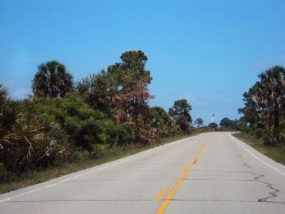
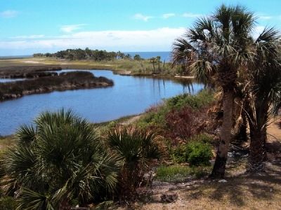
Location. 30° 4.431′ N, 84° 10.786′ W. Marker is in St. Marks, Florida, in Wakulla County. Marker is on Lighthouse Road, 10 miles south of Coastal Highway (U.S. 98) when traveling south. The marker lies at the terminus of Lighthouse Road, next to the lighthouse and near the shore of Goose Bay. The lighthouse sits on the east side of the mouth of the St. Marks River. Touch for map. Marker is in this post office area: Saint Marks FL 32355, United States of America. Touch for directions.
Other nearby markers. At least 8 other markers are within 6 miles of this marker, measured as the crow flies. Fatal B-17 Crash On St. Marks National Wildlife Refuge (approx. 1.2 miles away); The Old Store on the Wakulla River (approx. 5.7 miles away); San Marcos de Apalache (approx. 5.7 miles away); a different marker also named San Marcos de Apalache (approx. 5.7 miles away); Princess Malee "Milly" Francis (approx. 5.7 miles away); Fort St. Marks Military Cemetery
(approx. 5.7 miles away); Fort San Marcos de Apalache (approx. 5.7 miles away); Telltale Bones (approx. 5.8 miles away). Touch for a list and map of all markers in St. Marks.
Also see . . .
1. St. Marks Lighthouse History Brochure. U.S. Fish & Wildlife Service PDF (Submitted on March 14, 2022, by Larry Gertner of New York, New York.)
2. Welcome to St. Marks NWR. The official site for the St. Marks National Wildlife Refuge. (Submitted on July 28, 2013, by Jamie Abel of Westerville, Ohio.)
Credits. This page was last revised on March 14, 2022. It was originally submitted on July 28, 2013, by Jamie Abel of Westerville, Ohio. This page has been viewed 648 times since then and 30 times this year. Photos: 1, 2, 3, 4, 5, 6. submitted on July 28, 2013, by Jamie Abel of Westerville, Ohio. • Bill Pfingsten was the editor who published this page.
