Perrysburg in Wood County, Ohio — The American Midwest (Great Lakes)
Fort Meigs Union Cemetery
Photographed by Don Morfe, July 18, 2013
1. Fort Meigs Union Cemetery Marker
Front Side of the marker
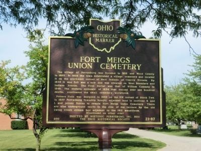
The village of Perrysburg was founded in 1816 and Wood County in 1820. In 1822 the town established a village cemetery and located it on the southwest corner of West Indiana at Cherry Streets. By 1848 it was full and a new one was created on West Boundary and Indiana Avenue. The first burial was that of William Cassady in 1849. The cholera epidemic of 1854 that caused over one hundred deaths, overloaded the small cemetery workforce.
Potters Field was designed in 1868 on the NW corner of Block Two. In 1877 Perrysburg Township bought adjacent land in sections K and L and joined forces to create Fort Meigs Union Cemetery. There are nine underground vaults in the side of the terrace by the old Ewing Creek stream bed adjacent to the 1912 mausoleum.
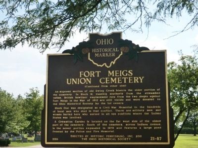
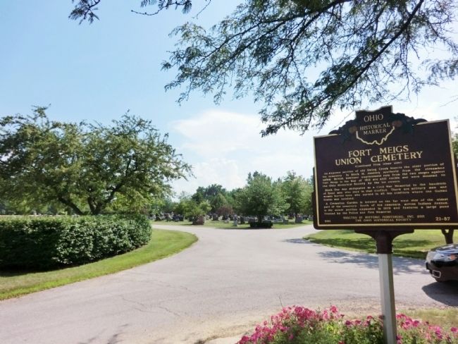
An exposed section of old Ewing Creek bisects the older portion of the cemetery In Block M, running southerly from the streambed valley, British howitzer emplacement ruts from the two sieges against Fort Meigs in the War of 1812 are still visible and were donated to the Ohio Historical Society by the lot owners.
Block One was designated as a Civil War Memorial to the hundreds
this page online
A Cremation Garden is located on the far west side of the oldest part of the cemetery. South of the cemetery, across Indiana Avenue, is the newer portion expanded in 1979 and features a large pond fronted by the Police and Fire Memorial.
Erected 2011 by Historic Perrysburg, Inc. and the Ohio Hstorical Society. (Marker Number 21-87.)
Topics and series. This historical marker is listed in these topic lists: Cemeteries & Burial Sites • Forts and Castles • War, US Civil. In addition, it is included in the Ohio Historical Society / The Ohio History Connection series list. A significant historical year for this entry is 1816.
Location. 41° 33.083′ N, 83° 38.5′ W. Marker is in Perrysburg, Ohio, in Wood County. It is on West Indiana Avenue west of West Boundary Street. Touch for map. Marker is in this post office area: Perrysburg OH 43551, United States of America. Touch for directions.

Regionally, this marker is in the Black Swamp, in the Till Plains, and in the Toledo
Photographed by Don Morfe, July 18, 2013
2. Fort Meigs Union Cemetery Marker Reverse
Other nearby markers. At least 8 other markers are within walking distance of this marker: Veterans Memorial (within shouting distance of this marker); Fort Meigs Union Cemetery Potter's Field (approx. 0.2 miles away); Interior Earthworks (approx. 0.4 miles away); Perrysburg (approx. 0.4 miles away); First Siege (approx. 0.4 miles away); Discipline (approx. 0.4 miles away); Camp Life (approx. 0.4 miles away); Gardens (approx. half a mile away). Touch for a list and map of all markers in Perrysburg.
Other markers no longer nearby. to Fort Meigs / to Fort Meigs (was approx. 0.3 miles away but has been confirmed missing); to Fort Stephenson / to Fort Meigs (was approx. 0.3 miles away but has been confirmed missing).
Photographed by Don Morfe, July 18, 2013
3. Fort Meigs Union Cemetery Marker
Credits. This page was last revised on July 25, 2021. It was originally submitted on August 11, 2013, by Don Morfe of Baltimore, Maryland. This page has been viewed 1,372 times since then and 108 times this year. Photos: 1, 2, 3. submitted on August 11, 2013, by Don Morfe of Baltimore, Maryland. • Al Wolf was the editor who published this page.
