
Windsor in Bertie County, North Carolina — The American South (South Atlantic)
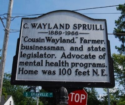
C. Wayland Spruill
1889-1966
Photographed by Mike Wintermantel, August 9, 2013
1. C. Wayland Spruill Marker
Topics. This historical marker is listed in these topic lists: Agriculture • Industry & Commerce • Science & Medicine.
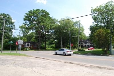
Location. 35° 59.788′ N, 76° 57.047′ W. Marker is in Windsor, North Carolina, in Bertie County. It is at the intersection of Sterlingworth Street (State Highway 308) and Granville Street (U.S. 13), on the left when traveling south on Sterlingworth Street. Touch for map. Marker is in this post office area: Windsor NC 27983, United States of America. Touch for directions.

Regionally, this marker is in North Carolina’s Coastal Plain. It is also in the American South, specifically in the Upper South, in the Tidewater, and on the Eastern Seaboard. Globally, it is in the North Atlantic Region, North America, the Western Hemisphere, the Western World, and the Anglosphere. Historically, it finds itself in what was once the territory of the Mississippian Culture, one of the original Thirteen Colonies, one of the Confederate
this page online
Other nearby markers. At least 8 other markers are within walking distance of this marker: Bertie Academy (within shouting distance of this marker); Bertie County Confederate Monument (approx. 0.3 miles away); "Windsor Castle" (approx. 0.3 miles away); Perry Stables (approx. 0.3 miles away); William Blount (approx. 0.3 miles away); WWII POW Camp (approx. 0.4 miles away); Roanoke River Underground Railroad Trail (approx. half a mile away); Dugout Canoe (approx. half a mile away). Touch for a list and map of all markers in Windsor.
Photographed by Mike Wintermantel, August 9, 2013
2. C. Wayland Spruill Marker
Credits. This page was last revised on November 28, 2019. It was originally submitted on August 12, 2013, by Mike Wintermantel of Pittsburgh, Pennsylvania. This page has been viewed 1,140 times since then and 47 times this year. Photos: 1, 2. submitted on August 12, 2013, by Mike Wintermantel of Pittsburgh, Pennsylvania.
