West Ashley in Charleston in Charleston County, South Carolina — The American South (South Atlantic)
Foundations of the Southern Plantation
Photographed by Bill Coughlin, August 6, 2013
1. Foundations of the Southern Plantation Marker
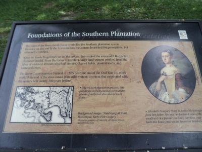
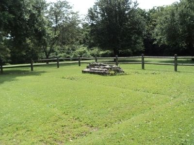
The ruins of the Horry family home symbolize the Southern plantation system. Founded on this soil by the first colonists, the system flourished for generations, but ultimately crumbled.
When the Lords Proprietors set up the colony, they copied the successful Barbadian plantation model. From Barbados to Carolina, large land-owners profited from the labor of enslaved Africans who built homes, cleared fields, planted seeds, and harvested crops.
The Horry-Lucas mansion burned in 1865 near the end of the Civil War. Its ashes marked the end of the slave-based plantation system; a system that originated with the settlers here nearly 200 years before.
Topics. This historical marker is listed in these topic lists: African Americans • Agriculture • Settlements & Settlers • War, US Civil. A significant historical year for this entry is 1865.
Location. 32° 48.266′ N, 79° 59.1′ W. Marker is in Charleston, South Carolina, in Charleston County. It is in West Ashley. It can be reached from Old Town Plantation Road. Marker is located on the History Trail at Charles Towne Landing. Touch for map. Marker is at or near this postal
this page online

Regionally, this marker is in the Lowcountry. It is also in the American South, specifically in the Deep South, and on the Eastern Seaboard. Globally, it is in the North Atlantic Region, North America, the Western Hemisphere, the Western World, and the Anglosphere. Historically, it finds itself in what was once the territory of the Mississippian Culture, one of the original Thirteen Colonies, one of the Confederate States of America, and the Antebellum South.
Other nearby markers. At least 8 other markers are within walking distance of this marker: Tales of the Tub (within shouting distance of this marker); a different marker also named Foundations of the Southern Plantation (within shouting distance of this marker); In Need of an Ally (about 400 feet away, measured in a direct line); Cassique of the Kiawah (about 400 feet away); The Search Goes On (about 400 feet away); In Trust (about 500 feet away); Site of Old Charles Town (about 500 feet away); Ghost Structure (about 500 feet away). Touch for a list and map of all markers
Photographed by Bill Coughlin, August 6, 2013
2. Foundations of the Southern Plantation Marker
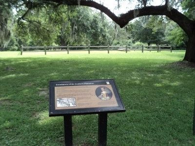
An identical marker is located on the east side of this field.
More about this marker. The background of the marker contains an image of a “Field Gang at Work, Martinique, Early 19th Century. Illustration courtesy of University of Virginia Library, Special Collections.”
A map of the Horry-Lucas Plantation ( “1836 Plat courtesy of Stanley South”) appears at the lower left of the marker. It has a caption of “Like its Barbadian counterparts, this plantation included homes for both the planter family and its enslaved work force.”
A portrait of Elizabeth Branford Horry, courtesy of Boykin Rose is on the right side of the marker. It has a caption of “Elizabeth Branford Horry inherited he plantation from her father. She and her husband, one of the wealthiest rice planters in South Carolina, may have built this house prior to the American Revolution.”
Photographed by Bill Coughlin, August 6, 2013
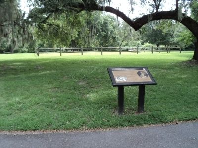
3. Marker at Charles Towne Landing
Photographed by Bill Coughlin, August 6, 2013
4. Foundations of the Southern Plantation
Credits. This page was last revised on February 16, 2023. It was originally submitted on August 19, 2013, by Bill Coughlin of Woodland Park, New Jersey. This page has been viewed 1,070 times since then and 57 times this year. Photos: 1, 2, 3, 4. submitted on August 19, 2013, by Bill Coughlin of Woodland Park, New Jersey.
