West Ashley in Charleston in Charleston County, South Carolina — The American South (South Atlantic)
Seized!
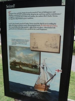
Thomas Gray and John Pinkerd stood accused of “Acts of delinquency and rebellion committed in and aboard the sloop by the said Gray and his confederates.” As fugitives wanted by the Colony of Carolina, the outlaws fled Charles Towne, leaving their ship behind in poor condition.
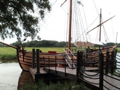
In 1673, the Grand Council of Charles Towne seized the ship for use in settling the debts of its disgraced former owners. Renaming the ketch The Fellowship of Carolina, the Council ordered the ship repaired – right at this very place – then loaded with goods and sent to Barbados to turn a profit for the Lords Proprietors.
Topics. This historical marker is listed in these topic lists: Colonial Era • Settlements & Settlers • Waterways & Vessels. A significant historical year for this entry is 1673.
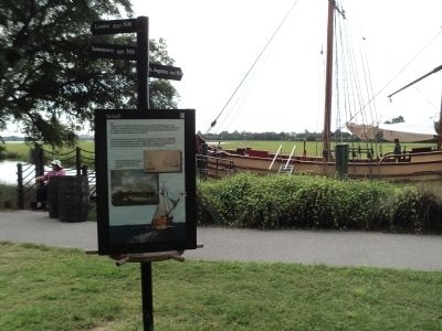
Location. 32° 48.054′ N, 79° 58.998′ W. Marker is in Charleston, South Carolina, in Charleston County. It is in West Ashley. Marker can be reached from Old Town Plantation Road. Marker is located on the History Trail at Charles Towne Landing. Touch for map. Marker is at or near this postal address: 1500 Old Towne Road, Charleston SC 29407, United States of America. Touch for directions.
Other nearby markers. At least 8 other markers are within walking distance of this marker. Ship Shaping (here, next to this marker); Harnessing the Wind (here, next to this marker); The Adventure, Trading Ketch (here, next to this marker); Postponed Aspirations (within shouting distance of this marker); Trade, Profits and Support (about 300 feet away, measured in a direct line); On the Edge of an Empire (about 400 feet away); Mixed Results (about 400 feet away); A Common Lodging (about 600 feet away). Touch for a list and map of all markers in Charleston.
More about this marker. A picture of a Charles Towne ship at sea appears at the bottom of the marker. Two other pictures appear on the marker. One is a painting of three ships on the water, and has a caption of “The smaller vessel depicted in this 17th-century painting by William Van de Velde, the Elder is a ketch.” The second painting, “The Island of Onrust” by Ludolf Bakhuizen shows a vessel under repair.
Credits. This page was last revised on February 16, 2023. It was originally submitted on August 21, 2013, by Bill Coughlin of Woodland Park, New Jersey. This page has been viewed 652 times since then and 11 times this year. Photos: 1, 2, 3. submitted on August 21, 2013, by Bill Coughlin of Woodland Park, New Jersey.


