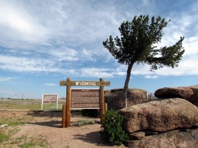
Near Buford in Albany County, Wyoming — The American West (Mountains)
Lonetree on the Laramie Range
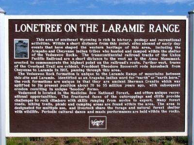
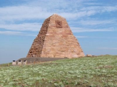
This area of southeast Wyoming is rich in history, geology and recreational activities. Within a short distance from this point, sites abound of early day events that have shaped the western heritage of this area, including the Arapaho and Cheyenne Indian tribes who hunted and camped within the shelter of the Vedauwoo Rocks. The transcontinental railroad tracks of the Union Pacific Railroad are a short distance to the west as is the Ames Monument, erected to commemorate the highest point of the railroad's route. Further west, traces of the Overland Trail are evident. President Theodore Roosevelt rode horseback from Cheyenne to Laramie in 1903, passing through this area.
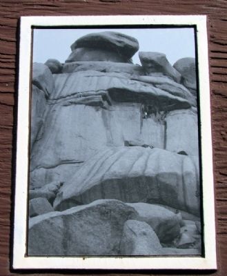
The Vedauwoo Rock formation is unique to the Laramie Range of mountains between this site and Laramie. Identified as an Arapaho Indian word for "earth" or "earth born," the rock formations are unique in that they are ancient Sherman Granite which was uplifted to its present position about 70 to 55 million years ago, with subsequent erosion resulting in unique 'hoodoo' forms.
Vedawood is located in the Medicine Bow National Forest, and offers unique recreational opportunities. The fractured faces of the outcroppings and cliffs provide challenges to rock climbers with skills ranging from novice to expert. Many forest roads, hiking trails, picnic and camping areas are found within the area. The area is designated for multiple use, and livestock share the forage and natural forest shelter with wildlife. Periodic cultural dance and music performances are held within the rocks.
Topics and series. This historical marker is listed in these topic lists: Environment • Native Americans • Railroads & Streetcars. In addition, it is included in the Former U.S. Presidents: #26 Theodore Roosevelt series list. A significant historical year for this entry is 1903.
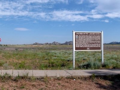
Location. 41° 8.017′ N, 105° 20.817′ W. Marker is near Buford, Wyoming, in Albany County. Marker can be reached from Interstate 80 at milepost 332, on the left when traveling east. The marker is located in a median pullout on I-80. It is 3.3 miles east of Exit 329 and 2.3 miles west of Exit 335. Touch for map. Marker is in this post office area: Buford WY 82052, United States of America. Touch for directions.
Other nearby markers. At least 8 other markers are within 9 miles of this marker, measured as the crow flies. Tree in the Rock (a few steps from this marker); Tree Rock (a few steps from this marker); Sherman Mountains (a few steps from this marker); Ames Monument (approx. 2.7 miles away); The Transcontinental Railroad (approx. 2.7 miles away); Pyramid on the Plains (approx. 2.7 miles away); Old Sherman Cemetery (approx. 2.8 miles away); The Purple Heart Trail (approx. 8˝ miles away). Touch for a list and map of all markers in Buford.
Also see . . . The History of Vedauwoo. From the Vedauwoo.org website. The website is primarily about rock climbing, but has lots of information on the Vedauwoo rock formation. (Submitted on August 24, 2013, by Duane Hall of Abilene, Texas.)
Credits. This page was last revised on August 1, 2020. It was originally submitted on August 24, 2013, by Duane Hall of Abilene, Texas. This page has been viewed 1,574 times since then and 84 times this year. Photos: 1, 2, 3, 4, 5, 6. submitted on August 24, 2013, by Duane Hall of Abilene, Texas.
