Greenwich in Greater London, England, United Kingdom — Northwestern Europe (the British Isles)
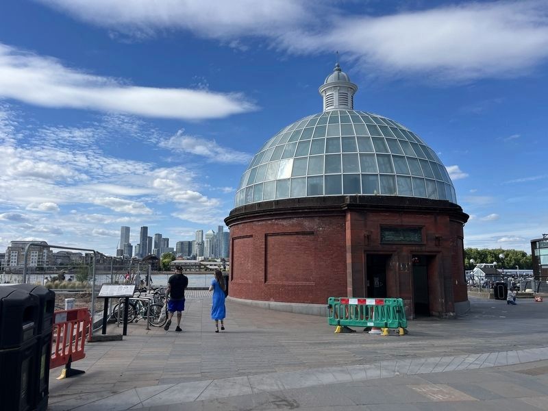
Greenwich Foot Tunnel
Photographed by Roger W. Sinnott, August 19, 2013
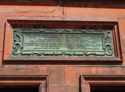
1. Greenwich Foot Tunnel Marker
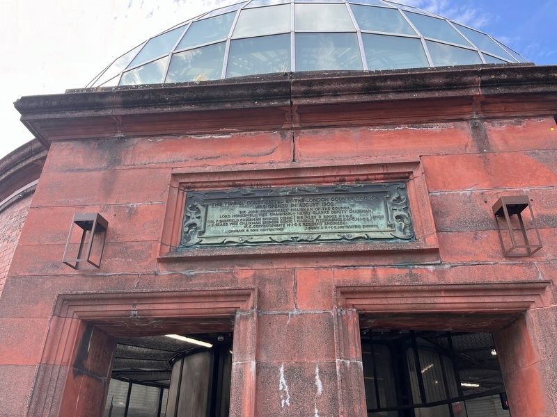
Sir John MacDougall chairman of the Council; Lord Monkswell vice chairman; Henry Clarke deputy chairman; Col F. Sheffield chairman bridges comm; J. E. Sears vice chairman bridges comm; Sir Alex R Binnie MICE, Maurice FitzMaurice CMG, MICE, engrs; W. C. Copperthwaite MICE resident engineer.
J. Cochrane & Sons contractors; J. Brown AMICE, contractors engineer.
Topics. This historical marker is listed in these topic lists: Man-Made Features • Roads & Vehicles. A significant historical year for this entry is 1902.
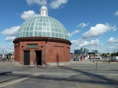
Location. 51° 28.994′ N, 0° 0.61′ W. Marker is in Greenwich, England, in Greater London. It can be reached from Thanes Path. Marker is mounted above the Greenwich entrance to the foot tunnel, on the south bank of the Thames River. Touch for map. Marker is in this post office area: Greenwich, England SE10 9HT, United Kingdom. Touch for directions.

Regionally, this marker is in the Greater South East. Globally, it is on the Atlantic Ocean, in the North Atlantic Region, in Europe, in Atlantic Europe, on one of the British
this page online
Other nearby markers. At least 8 other markers are within walking distance of this marker: A different marker also named Greenwich Foot Tunnel (a few steps from this marker); New Zealand Memorial (about 90 meters away, measured in a direct line); Turkish Bronze Gun (about 90 meters away); Bellot Memorial (about 180 meters away); Britain's Oldest Brewer (about 180 meters away); a different marker also named Greenwich Foot Tunnel (approx. 0.4 kilometers away); Byer’s improved stockless anchor, 1953 (approx. 0.4 kilometers away); Hall’s improved stockless anchor, 1963 (approx. 0.4 kilometers away). Touch for a list and map of all markers in Greenwich.
More about this marker. The "MICE" on the marker are Members of the Institution of Civil Engineers.
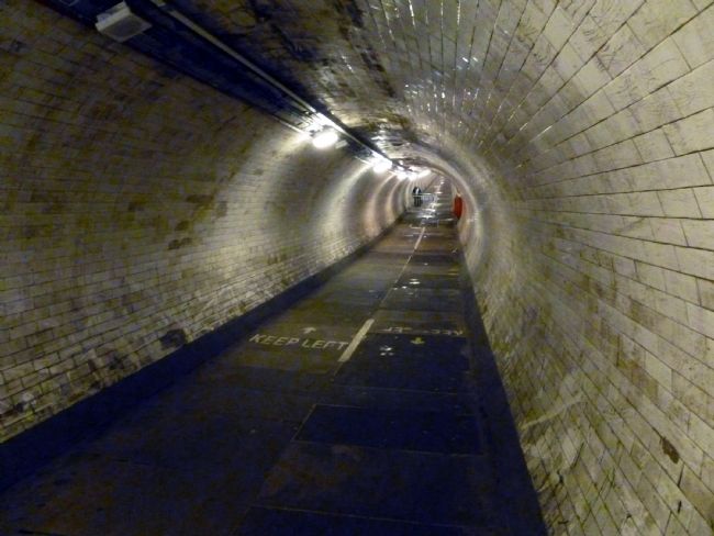
Regarding Greenwich Foot Tunnel. The Greenwich Foot Tunnel allows people to walk freely under the Thames River between Greenwich and the East End of London. It is ¼ mile long.
The tunnel entrances on both sides of the river have lifts, making the tunnel wheelchair
Photographed by Adam Margolis, June 16, 2026
2. Greenwich Foot Tunnel Marker
Also see . . . Visitor’s Guide. (Submitted on August 26, 2013, by Roger W. Sinnott of Norwell, Massachusetts.)
Additional keywords. Tunnel
Photographed by Roger W. Sinnott, August 19, 2013
3. Domed Tunnel Entrance (Greenwich Side)
Photographed by Roger W. Sinnott, August 19, 2013
4. View Down the Tunnel
Photographed by Adam Margolis, June 16, 2026
5. Greenwich Foot Tunnel Marker
Credits. This page was last revised on July 9, 2026. It was originally submitted on August 26, 2013, by Roger W. Sinnott of Norwell, Massachusetts. This page has been viewed 804 times since then and 31 times this year. Photos: 1. submitted on August 26, 2013, by Roger W. Sinnott of Norwell, Massachusetts. 2. submitted on June 30, 2026, by Adam Margolis of Mission Viejo, California. 3, 4. submitted on August 26, 2013, by Roger W. Sinnott of Norwell, Massachusetts. 5. submitted on June 30, 2026, by Adam Margolis of Mission Viejo, California. • Andrew Ruppenstein was the editor who published this page.
