Montgomery in Montgomery County, Alabama — The American South (East South Central)
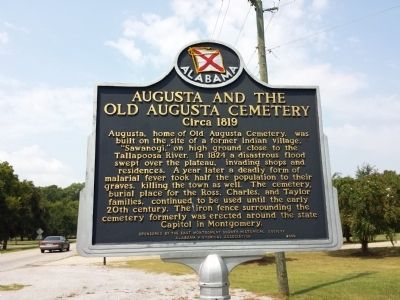
Augusta and the Old Augusta Cemetery
Circa 1819
Erected 2006 by East Montgomery County Historical Society and the Alabama Historical Association.
Topics and series. This historical marker is listed in these topic lists: Cemeteries & Burial Sites • Disasters • Native Americans. In addition, it is included in the Alabama Historical Association series list. A significant historical year for this entry is 1824.
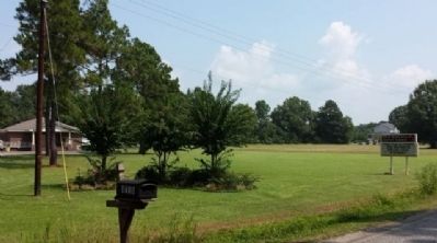
Location. 32° 24.726′ N, 86° 7.895′ W. Marker is in Montgomery, Alabama, in Montgomery County. Marker is on Wares Ferry Road (County Route 64) 0.4 miles east of Dozier Road, on the left when traveling east. Touch for map. Marker is at or near this postal address: 8511 Wares Ferry Road, Montgomery AL 36117, United States of America. Touch for directions.
Other nearby markers. At least 8 other markers are within 6 miles of this marker, measured as the crow flies. Antioch Baptist Church (approx. 4.3 miles away); Georgia Washington School (approx. 4.4 miles away); Grace Episcopal Church (approx. 4˝ miles away); Chantilly Plantation (approx. 4.9 miles away); Ray Cemetery (approx. 5.1 miles away); Madison Park School (approx. 5.3 miles away); Union Chapel A.M.E. Zion Church (approx. 5.4 miles away); Old Elam Baptist Church Cemetery (approx. 5.9 miles away). Touch for a list and map of all markers in Montgomery.
Credits. This page was last revised on June 16, 2016. It was originally submitted on August 31, 2013, by Mark Hilton of Montgomery, Alabama. This page has been viewed 1,025 times since then and 85 times this year. Photos: 1, 2. submitted on August 31, 2013, by Mark Hilton of Montgomery, Alabama. • Bernard Fisher was the editor who published this page.

