Marker Logo HMdb.org THE HISTORICAL
MARKER DATABASE
“Bite-Size Bits of Local, National, and Global History”
Niles in Berrien County, Michigan — The American Midwest (Great Lakes)
 

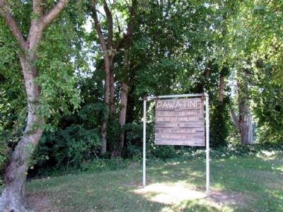
PA-WA-TING

(Great Crossing)


PA-WA-TING Marker image. Click for full size.
Photographed By Duane Hall, September 6, 2013
1. PA-WA-TING Marker
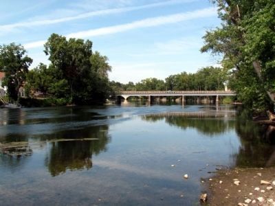
Inscription. Here the Old Sauk Trail forded the O-Sang-E-Wong-Se-Be now known as the Saint Joseph River.
 
Topics. This historical marker is listed in these topic lists: Native AmericansRoads & Vehicles.
 
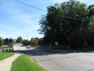
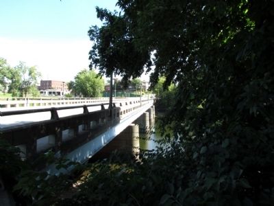
Location. 41° 49.643′ N, 86° 15.515′ W. Marker is in Niles, Michigan, in Berrien County. Marker is at the intersection of Grant Street and Parkway Street, on the right when traveling east on Grant Street. Marker is at southwest corner of the Clifford D. Eden Memorial Bridge over the St. Joseph River. Touch for map. Marker is in this post office area: Niles MI 49120, United States of America. Touch for directions.
 
Other nearby markers. At least 8 other markers are within walking distance of this marker. Wesley United Methodist Church (approx. 0.2 miles away); Trinity Church (approx. 0.2 miles away); Parrott Civil War Cannon (approx. 0.2 miles away); Niles Veterans Memorial (approx. 0.2 miles away); John B. Reddick Building (approx. ¼ mile away); Four Flags Hotel (approx. ¼ mile away); The Old Fifth Street Viaduct (approx. 0.3 miles away); The Chapin House / Henry Austin Chapin (approx. 0.3 miles away). Touch for a list and map of all markers in Niles.
 
Paid Advertisement
Click on the ad for more information.
Please report objectionable advertising to the Editor.
Click or scan to see
this page online
PA-WA-TING Marker image. Click for full size.
Photographed By Duane Hall, September 6, 2013
2. PA-WA-TING Marker
PA-WA-TING Marker image. Click for full size.
Photographed By Duane Hall, September 6, 2013
3. PA-WA-TING Marker
View to east along Grant Street
and Clifford D. Eden Memorial Bridge
St. Joseph River near Marker image. Click for full size.
Photographed By Duane Hall, September 6, 2013
4. St. Joseph River near Marker
Location of Old Sauk Trail ford<br>across the St. Joseph River image. Click for full size.
Photographed By Duane Hall, September 6, 2013
5. Location of Old Sauk Trail ford
across the St. Joseph River
Marker is to the left of the bridge
 
 
Credits. This page was last revised on June 16, 2016. It was originally submitted on September 7, 2013, by Duane Hall of Abilene, Texas. This page has been viewed 793 times since then and 68 times this year. Photos:   1, 2, 3, 4, 5. submitted on September 7, 2013, by Duane Hall of Abilene, Texas.

Share this page.  
Share on Tumblr
m=68474

CeraNet Cloud Computing sponsors the Historical Marker Database.
This website earns income from purchases you make after using our links to Amazon.com. We appreciate your support.
Paid Advertisement
Apr. 23, 2024