Reservoir Park in Harrisburg in Dauphin County, Pennsylvania — The American Northeast (Mid-Atlantic)
Reservoir Park
Photographed by William Pfingsten, March 30, 2008
1. Reservoir Park Marker
Inscription.
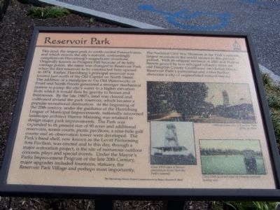
This land, the largest park in south-central Pennsylvania, and which crowns the city's summit, contrastingly complements Harrisburg's magnificent riverfront. Originally known as Prospect Hill because of its lofty vantage points, the name was changed to Reservoir Park when the first reservoir to be constructed here opened in 1874. Earlier, Harrisburg's principal reservoir was located just north of the Old Capitol on North Street. The addition of a standpipe on the Old Waterworks at Front and North Streets generated a stronger mechanical system to pump the city's water to a higher elevation from which it would flow by gravity to homes and businesses. By the late 1880's, land was cleared and cultivated around the park reservoir, which became a popular recreational destination. At the beginning of the 20th century, under the guidance of the Harrisburg League of Municipal Improvements, nationally renowned landscape architect Warren manning was retained to design major park improvements. The Park was expanded to its present size of 90 acres and additional reservoirs, tennis courts, picnic pavilions, a nine-hole golf course and
Click or scan to see this page online
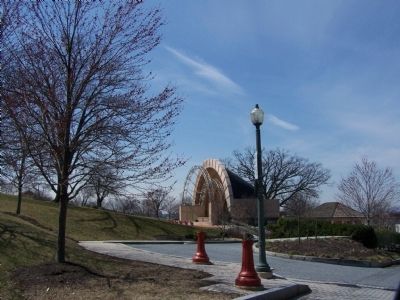
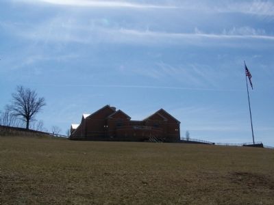
an observation tower were developed. The Park's band shell, now known as the Levitt Performing Arts Pavilion, was erected and to this day, through a major restoration project, is the site of numerous outdoor concerts, plays and special events. Under the Mayor's Parks Improvement Program of the late 20th Century, major upgrades included fountains, statuary, the Reservoir Park Village and perhaps most importantly, The National Civil War Museum at the Park's summit, largest museum in the world related to this pivotal period. With its original entrance at 18th and Walnut Streets graced by two salvaged columns from the old Dauphin County Courthouse on Market Street, Reservoir Park's panoramas and vistas further showcase a city of unparalleled natural beauty. Top Photo 1905 postcard view of Reservoir Park picnic pavilion.
Bottom Left Photo Circa 1910 view of former observation tower near the Park's summit.
Bottom Right Photo Circa 1905 postcard view of primary reservoir looking east.
Erected by The Harrisburg History Project Commissioned by Mayor Stephen R. Reed.
Topics and series. This historical marker is listed in these topic
Location. 40° 16.395′ N, 76° 51.573′ W. Marker is in Harrisburg, Pennsylvania, in Dauphin County. It is in Reservoir Park. It can be reached from the intersection of Walnut Street and Concert Drive when traveling east. Marker is near the Information Building at the entrance to the park. Touch for map. Marker is at or near this postal address: 2051 State St, Harrisburg PA 17103, United States of America. Touch for directions.
Regionally, this marker is in South-Central Pennsylvania, specifically in Pennsylvania Dutch Country, and in the Susquehanna Valley. It is also in the American Northeast and in the Mid-Atlantic. Globally, it is in North America, the Western Hemisphere, the Western World, and the Anglosphere. Historically, it finds itself in what was once the Haudenosaunee (Iroquois) Confederacy and also one of the original Thirteen Colonies.
Credits. This page was last revised on June 24, 2024. It was originally submitted on April 2, 2008, by Bill Pfingsten of Bel Air, Maryland. This page has been viewed 3,304 times since then and 130 times this year. Photos:1, 2, 3. submitted on April 2, 2008, by Bill Pfingsten of Bel Air, Maryland.