Greenbelt in Prince George's County, Maryland — The American Northeast (Mid-Atlantic)
Greenbelt Park
National Park Service, U.S. Department of the Interior
Photographed by F. Robby, September 10, 2013
1. Greenbelt Park Marker
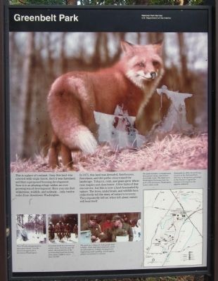
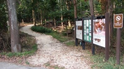
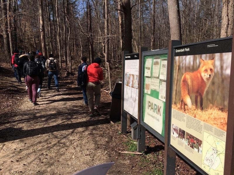
In 1875, this land was denuded; farmhouses, fencelines, and dirt paths crisscrossed the landscape. Tobacco, corn, and grain grew where now maples and elms tower. A few hints of that era survive, but this is now a land dominated by nature. The trees, underbrush, and wildlife here collectively tell the story of nature’s recovery. They repeatedly tell us: when left alone, nature will heal itself.
[text with image lower left] The 174-site campground is open year-round. It is the closest campground to downtown Washington.
[text with image lower middle] Greenbelt Park has become an urban oasis. Over the past 60 years, the population of the surrounding land has grown from about 3,000 to more than 20,000. [text with image lower right] The park is a refuge for both people and wildlife. Park staff and volunteers
this page online
[text with map on right] The park includes a campground, three picnic areas, and nature and bridle trails. The Baltimore-Washington Parkway links the park with downtown Washington, twelve miles south.
Dedicated in 1954, the parkway (a unit of the National Park Service) is the historic gateway to the Nation’s Capital for visitors arriving from the eastern seaboard.
Erected by National Park Service, U.S. Department of the Interior.
Topics. This historical marker is listed in these topic lists: Environment • Horticulture & Forestry • Parks & Recreational Areas. A significant historical year for this entry is 1875.
Location. 38° 59.307′ N, 76° 53.832′ W. Marker is in Greenbelt, Maryland, in Prince George's County. It can be reached from Greenbelt Road (Maryland Route 193) 0.7 miles west of Southway when traveling west. Marker is in Greenbelt Park, on the drive toward the campground. Touch for map. Marker is in this post office area: Greenbelt MD 20770, United States of America. Touch for directions.

Regionally,
Photographed by F. Robby, September 10, 2013
2. Greenbelt Park Marker
Other nearby markers. At least 8 other markers are within walking distance of this marker: Time of Horror (approx. 0.4 miles away); a different marker also named Greenbelt Park (approx. 0.4 miles away); Greenbelt: A Bold Experiment (approx. 0.4 miles away); Edmonston Road (approx. half a mile away); Town of Berwyn Heights (approx. half a mile away); Carrington Avenue (approx. 0.6 miles away); Toaping Castle (approx. 0.6 miles away); a different marker also named Greenbelt: A Bold Experiment (approx. 0.6 miles away). Touch for a list and map of all markers in Greenbelt.
Photographed by Adam Margolis
3. Greenbelt Park Marker
Credits. This page was last revised on January 18, 2022. It was originally submitted on September 15, 2013, by F. Robby of Baltimore, Maryland. This page has been viewed 578 times since then and 25 times this year. Photos: 1, 2. submitted on September 15, 2013, by F. Robby of Baltimore, Maryland. 3. submitted on January 9, 2022, by Adam Margolis of Mission Viejo, California. 4. submitted on August 19, 2018, by Devry Becker Jones of Washington, District of Columbia.
