Near Morton in Renville County, Minnesota — The American Midwest (Upper Plains)
Redwood Ferry
Inscription.
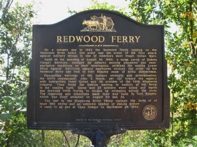
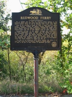
On a summer day in 1862 the Redwood Ferry landing on the Minnesota River below this point was the scene of the first attack against military troops in one of America's most tragic Indian wars.
Early in the morning of August 18, 1862, a large party of Dakota (Sioux) warriors, enraged by delayed annuity payments and near-starvation conditions on their reservation, attacked the nearby Lower Sioux Agency. Surviving agency employees crossed the river on the Redwood ferry and fled to Fort Ridgely some 13 miles downstream.
Discounting warnings of the Indian's strength and determination, the fort's commandant, John S. Marsh, set out toward the agency with interpreter Peter Quinn and 46 soldiers of the Fifth Minnesota Infantry. They found the Dakota waiting in ambush at the ferry. In the ensuing fight, Quinn and 23 soldiers were killed and Marsh was drowned while trying to escape by swimming across the river. The remaining men eventually made their way back to Fort Ridgely, which was itself attacked on August 20 and 22.
The war in the Minnesota River Valley claimed the lives of at least 450 whites and an unknown number of Dakota before it came to an end at Camp Release on September 26, 1862.
1985
Erected 1985 by the Minnesota Historical Society.
Topics and series. This historical marker is listed in these topic lists: Wars, US Indian • Waterways & Vessels. In addition, it is included in the Minnesota Historical Society series list. A significant historical date for this entry is September 26, 1862.
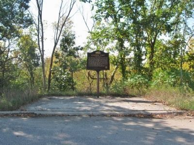
Location. 44° 32.299′ N, 94° 56.35′ W. Marker is near Morton, Minnesota, in Renville County. Marker is on State Highway 19 at milepost 81.5,, 3 miles east of U.S. 71, on the right when traveling east. Marker is at a paved wide shoulder pull-off area between 645th Avenue (County Road 51) and 370th Street. Touch for map. Marker is in this post office area: Franklin MN 55333, United States of America. Touch for directions.
Other nearby markers. At least 8 other markers are within 2 miles of this marker, measured as the crow flies. Court Martial Site (approx. 1.4 miles away); The Remains of Hon. J.W. Lynde (approx. 1˝ miles away); Myrick's Trading Post Site (approx. 1˝ miles away); Forbes' Trading Post Site (approx. 1˝ miles away); Robert's Trading Post Site (approx. 1.6 miles away); Solid Friendships (approx. 1.9 miles away); The Faithful Indians' Monument (approx. 1.9 miles away); Surrounded at the Coulee (approx. 1.9 miles away). Touch for a list and map of all markers in Morton.
Also see . . .
1. Redwood Ferry Site. Dakota Conflict website entry (Submitted on September 29, 2013.)
2. Battle of Redwood Ferry. Wikipedia entry. (Submitted on September 29, 2013.)
3. The Chatfield Boys and the Fight at Redwood Ferry. The Chatfield News entry (Submitted on September 29, 2013.)
Additional keywords. U.S.-Dakota War of 1862
Credits. This page was last revised on June 12, 2023. It was originally submitted on September 29, 2013, by Keith L of Wisconsin Rapids, Wisconsin. This page has been viewed 1,552 times since then and 119 times this year. Photos: 1, 2, 3, 4, 5. submitted on September 29, 2013, by Keith L of Wisconsin Rapids, Wisconsin.
