
Carcross in Unorganized Yukon, Yukon — The Northern Territories (North America)
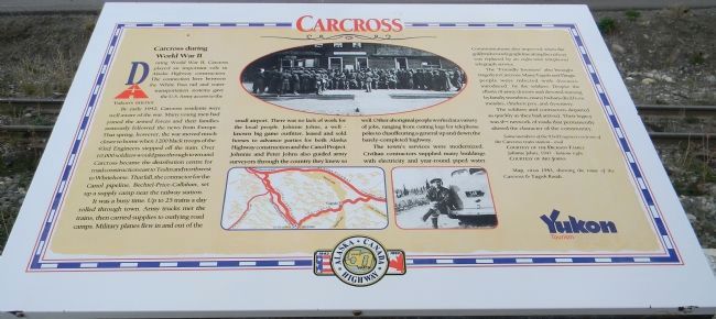
Carcross during World War II
Alaska-Canada Highway, 50 Years: 1942-1992
Photographed by Richard E. Miller, September 17, 2013
1. Carcross during World War II Marker
During World War II, Carcross played an important role in Alaska Highway construction. The connection here between the White Pass rail and water transportation systems gave the U.S. Army access to the Yukon’s interior.
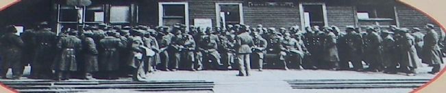
By early 1942, Carcross residents were well aware of the war. Many young men had joined the armed forces, and their families anxiously followed the news from Europe. That spring, however, the war moved much closer to home when 1200 Black troops of the 93rd Engineers stepped off the train. Over 10,000 soldiers would pass through town, and Carcross became the distribution centre for road construction east to Teslin and northwest to Whitehorse. That fall, the contractor for the Canol pipeline, Bechtel-Price-Callahan, set up a supply camp near the railway station.
It was a busy time. Up to 25 trains a day rolled through town. Army trucks met the trains, then carried supplies to outlying road camps. Military planes flew in and out of the small airport. There was no lack of work for the local people. Johnnie Johns, a well-known big game outfitter, leased and sold horses to advance parties for both Alaska Highway
this page online
The town’s services were modernized. Civilian contractors supplied many buildings with electricity and year-round piped water.
Communications also improved when the gold rush era telegraph line along the railway was replaced by an eight-wire telephone/telegraph service.
The “Friendly Invasion” also brought tragedy to Carcross. Many Tagish and Tlingit people were infected with diseases introduced by the soldiers. Despite the efforts of army doctors and devoted nursing by family members, many Indians died from measles, chicken pox, and dysentery.
The soldiers and contractors departed as quickly as they had arrived. Their legacy was the network of roads that permanently altered the character of the community.
[Photo captions:]
Some members of the 93rd Engineers in front of the Carcross train station – oval
Courtesy of the Dickson Family
Johnnie Johns,
Photographed by Richard E. Miller, September 17, 2013
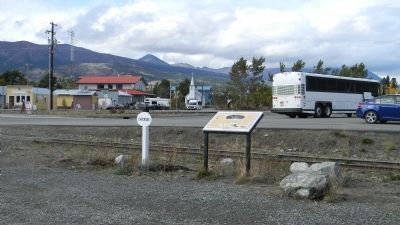
2. "Carcross during World War II" - marker near the tracks of the White Pass & Klondike Railway
Courtesy of Art Johns
Map, circa 1943, showing the route of Carcross & Tagish Roads
Erected 1992 by Yukon Tourism.
Topics. This historical marker is listed in these topic lists: African Americans • Indigenous Peoples and Communities • Roads & Vehicles • War, World II. A significant historical year for this entry is 1942.
Location. 60° 9.976′ N, 134° 42.347′ W. Marker is in Carcross, Yukon, in Unorganized Yukon. It can be reached from Klondike Highway (Yukon Route 2) north of Tagish Road. The marker is in the open area southwest of the Klondike Highway and northeast of the White Pass and Klondike Railway depot in Carcross. Touch for map. Marker is at or near this postal address: 272 Tagish Ave, Carcross YT Y1A 5Y9, Canada. Touch for directions.

Regionally, this marker is in the Canadian North. Globally, it is in North America, on the Ring of Fire, in the Arctic, in the Western Hemisphere, and in the Western World. Historically, it finds itself in what was once a British colony.
Other nearby markers. At least 8 other markers are within walking distance of this marker: Caribou Hotel Historic
Photographed by Richard E. Miller, September 17, 2013
3. Carcross during World War II: Black soldiers assembled in Carcross,1942
Additional keywords. "Caribou Crossing"; "The Yukon"; "First Nations"; ALCAN Highway
Credits. This page was last revised on November 22, 2022. It was originally submitted on September 29, 2013, by Richard E. Miller of Oxon Hill, Maryland. This page has been viewed 1,044 times since then and 38 times this year. Photos: 1. submitted on September 29, 2013, by Richard E. Miller of Oxon Hill, Maryland. 2, 3. submitted on September 30, 2013, by Richard E. Miller of Oxon Hill, Maryland. • Andrew Ruppenstein was the editor who published this page.
