Racine in Racine County, Wisconsin — The American Midwest (Great Lakes)
Racine, Wisconsin
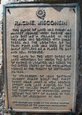
This block of land was known as Market Square when Racine was laid out as a village in 1837. This area was covered with shade trees, was the location of the town pump, and was used by the early settlers as a place to by and sell produce.
The land on the west shore of Lake Michigan, on which the city of Racine is located, was ceded to the United States by the Potawatomi Indians in the Treaty of September 26, 1833.
In November of 1834 Captain Gilbert Knapp built the first cabin near what is now Second Street and Lake Avenue, on the site he called Port Gilbert in the Territory of Wisconsin, which became the City of Racine, in the State of Wisconsin in 1848.
This marker was given by the Racine Chapter Daughters of the American Revolution June 14, 1962
Erected 1962 by Racine Chapter, Daughters of the American Revolution.
Topics and series. This historical marker is listed in these topic lists: Agriculture • Industry & Commerce • Native Americans • Settlements & Settlers. In addition, it is included in the Daughters of the American Revolution series list. A significant historical date for this entry is September 26, 1833.
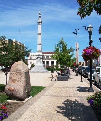
Location. 42° 43.627′ N, 87° 46.978′ W. Marker is in Racine, Wisconsin, in Racine County . Marker is on Main Street (State Highway 32) north of 6th Street (State Highway 32), on the left when traveling north. Marker is on Monument Square. Touch for map. Marker is in this post office area: Racine WI 53403, United States of America. Touch for directions.
Other nearby markers. At least 8 other markers are within walking distance of this marker. Jerome Increase Case / Mascot and Trademark (here, next to this marker); Joshua Glover Commemorative Marker (a few steps from this marker); Civil War Memorial (within shouting distance of this marker); Racine County Historical Museum (about 500 feet away, measured in a direct line); The Racine Harbor (approx. 0.2 miles away); Racine City Hall (approx. 0.3 miles away); Engine House No. 3 (approx. 0.3 miles away); Veterans Memorial (approx. 0.3 miles away). Touch for a list and map of all markers in Racine.
Also see . . .
1. Racine WI Timeline. (Submitted on October 10, 2013, by William Fischer, Jr. of Scranton, Pennsylvania.)
2. The history of Racine and Kenosha Counties, Wisconsin (1879). (Submitted on October 10, 2013, by William Fischer, Jr. of Scranton, Pennsylvania.)
Credits. This page was last revised on August 9, 2021. It was originally submitted on October 10, 2013, by William Fischer, Jr. of Scranton, Pennsylvania. This page has been viewed 780 times since then and 53 times this year. Photos: 1, 2. submitted on October 10, 2013, by William Fischer, Jr. of Scranton, Pennsylvania.

