Cross Plains in Callahan County, Texas — The American South (West South Central)
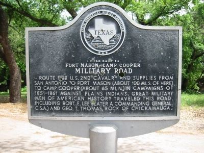
Fort Mason-Camp Cooper Military Road
Photographed by Richard Denney, May 20, 2002
1. Fort Mason-Camp Cooper Military Road Marker
Fort Mason-Camp Cooper
Military Road
Erected 1967 by State Historical Survey Committee. (Marker Number 1995.)
Topics. This historical marker is listed in these topic lists: Forts and Castles • Roads & Vehicles • Wars, US Indian.
Location. This marker has been replaced by another marker nearby. It was located near 32° 7.285′ N, 99° 10.53′ W. Marker was in Cross Plains, Texas, in Callahan County. It was on Southwest Fifth Street (State Highway 36) 0.2 miles west of South Comal Street, on the left when traveling west. Marker is located in a roadside park. Touch for map. Marker was in this post office area: Cross Plains TX 76443, United States of America. Touch for directions.

Regionally, this marker
this page online
Other nearby markers. At least 8 other markers are within 6 miles of this location, measured as the crow flies: A different marker also named Fort Mason-Camp Cooper Military Road (about 300 feet away, measured in a direct line); Home of Robert E. Howard (approx. 0.2 miles away); Cross Plains Cemetery (approx. 0.4 miles away); Higginbotham Brothers and Company (approx. 0.7 miles away); Cross Plains Review (approx. 0.7 miles away); Pioneer Cemetery War Memorial (approx. 5.6 miles away); Pioneer Cemetery (approx. 5.6 miles away); Old Cottonwood Cemetery (approx. 5.9 miles away). Touch for a list and map of all markers in Cross Plains.
More about this marker. This marker was replaced by a new marker in 2014; the new marker is located approx. 250 feet west of the original marker location.
Related marker. Click here for another marker
Photographed by Richard Denney, April 20, 2014
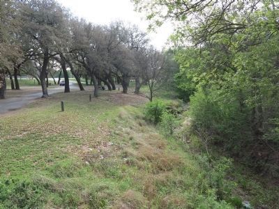
2. Roadside Park and Creek
The park and creek where markers are located. Old marker is among trees by picnic table.
Photographed by Duane Hall, December 25, 2014
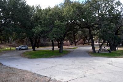
3. Location of Original Marker
The new marker is located at the pedestrian bridge to the right
Credits. This page was last revised on August 10, 2026. It was originally submitted on October 11, 2013, by Richard Denney of Austin, Texas. This page has been viewed 898 times since then and 51 times this year. Last updated on August 8, 2026, by Joe Lotz of Flower Mound, Texas. Photos: 1. submitted on October 11, 2013, by Richard Denney of Austin, Texas. 2. submitted on April 30, 2014, by Richard Denney of Austin, Texas. 3. submitted on December 26, 2014, by Duane Hall of Abilene, Texas. • Devry Becker Jones was the editor who published this page.
