Maryville in Blount County, Tennessee — The American South (East South Central)
Maryville During the Civil War
"A shameful...fire"
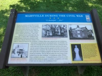
Fighting directly touched Maryville, the county seat, in August 1864. Confederate Gen. Joseph Wheeler’s cavalrymen attacked a small detachment of the 2nd Tennessee Infantry (U.S.) under Lt. James M. Dorton at the courthouse. A federal officer later reported that the Confederates, “not caring to hazard lives by storming the place, very foolishly, and I may say criminally set fire into the court-house and burn the enemy out; but instead of doing so the fire spread in all other directions and left the garrison uninjured. The result was all the business property and a great deal of residence property was destroyed, and the people turned out homeless. The fire did not injure the court-house, being isolated from the other buildings.” A Confederate soldier, William Sloan, confided in his diary: “A shameful feature of this fire is that nearly all the victims are people of southern sympathies, and many of their sons are away in the Confederate Army.”
(sidebar)
When Lt. James M. Dorton commandeered the courthouse as Union headquarters, the county records were moved to James Toole’s Main Street store. As the fire that the Confederates set spread to the store, former slave Polly Toole ignored the danger, entered the building, and saved the records. A statue of Polly Toole, honoring her bravery, stands in the courthouse today. Maryville recovered after the war, in part with the help of the Freedmen’s Bureau, which funded the construction of Anderson Hall at Maryville College.
(captions)
Blount County Courthouse, 1842-1879, by John Collins, ca. 1870 - Courtesy Friends Historical Collection, Guilford College, Greensboro, N.C.
George Toole House, used as Union headquarters, 1864 Courtesy The Daily Times, Dean Stone Collection
Samuel Pride House, occupied by officers of each side. Missing two-story porch burned during the war - Courtesy The Daily Times, Dean Stone Collection
Polly Toole by Sculptor Joyce McCroskey
Erected by Tennessee Civil War Trails.
Topics and series. This historical marker is listed in these topic lists: Abolition & Underground RR • African Americans • War, US Civil. In addition, it is included in the Tennessee Civil War Trails series list. A significant historical year for this entry is 1822.
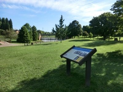
Location. 35° 45.369′ N, 83° 58.454′ W. Marker is in Maryville, Tennessee, in Blount County. Marker can be reached from the intersection of McCammon Avenue and McGhee Street, on the left when traveling east. The marker is located along the Maryville-Alcoa Greenway in Bicentennial Greenbelt Park. Touch for map. Marker is in this post office area: Maryville TN 37801, United States of America. Touch for directions.
Other nearby markers. At least 8 other markers are within walking distance of this marker. New Providence Church (approx. 0.2 miles away); Where Houston Enlisted (approx. 0.2 miles away); Louis Philippe's Visit (approx. 0.2 miles away); William Bennett Scott, Sr. (approx. 0.2 miles away); Montvale Springs (approx. ¼ mile away); General Sam Houston (approx. 0.3 miles away); “Battle of the Bulge” World War II Veterans of Blount County (approx. 0.3 miles away); Blount County Revolutionary War Memorial (approx. 0.3 miles away). Touch for a list and map of all markers in Maryville.
Credits. This page was last revised on June 16, 2016. It was originally submitted on October 17, 2013, by Don Morfe of Baltimore, Maryland. This page has been viewed 2,205 times since then and 120 times this year. Photos: 1, 2, 3. submitted on October 17, 2013, by Don Morfe of Baltimore, Maryland. • Bernard Fisher was the editor who published this page.


