Gainesville in Sumter County, Alabama — The American South (East South Central)
Town of Gainesville
Photographed by Cosmos Mariner, May 28, 2013
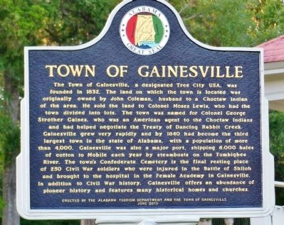
1. Town of Gainesville marker
The Town of Gainesville, a designated Tree City USA, was founded in 1832. The land on which the town is located was originally owned by John Coleman, husband to a Choctaw Indian of the area. He sold the land to Colonel Moses Lewis, who had the town divided into lots. The town was named for Colonel George Strother Gaines, who was an American agent to the Choctaw Indians and helped negotiate the Treaty of Dancing Rabbit Creek. Gainesville grew very rapidly and by 1840 had become the third largest town in the state of Alabama, with a population of more than 4,000. Gainesville was also a major port, shipping 6,000 bales of cotton to Mobile each year by steamboats on the Tombigbee River. The town’s Confederate Cemetery is the final resting place of 250 Civil War soldiers who were injured in the Battle of Shiloh and brought to the hospital in the Female Academy in Gainesville. In addition to Civil War History, Gainesville offers an abundance of pioneer history and features many historical homes and churches.
Erected 2010 by Alabama Tourism Department and the Town of Gainesville.
Topics and series. This historical
this page online
Location. 32° 49.37′ N, 88° 9.5′ W. Marker is in Gainesville, Alabama, in Sumter County. It is at the intersection of State Street (Alabama Route 116) and McKee Street ( Route 39), on the right when traveling south on State Street. Touch for map. Marker is in this post office area: Gainesville AL 35464, United States of America. Touch for directions.

Regionally, this marker is in the American South, specifically in the Deep South, and in the Black Belt. Globally, it is in North America, a Gulf of Mexico state, the Western Hemisphere, the Western World, and the Anglosphere. Historically, it finds itself in what was once New Spain, the territory of the Mississippian Culture, one of the Confederate States of America, and the Antebellum South.
Other nearby markers. At least 6 other markers are within 14 miles of this marker, measured as the crow flies:
Photographed by Cosmos Mariner, May 28, 2013
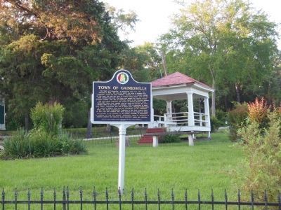
2. Town of Gainesville marker
Small town park with covered gazebo in the background.
Related markers. Click here for a list of markers that are related to this marker.
Also see . . .
1. Treaty of Dancing Rabbit Creek. Gainesville was named for Colonel George Strother Gaines, who was an American agent to the Choctaw Indians and helped negotiate the Treaty of Dancing Rabbit Creek. (Submitted on October 25, 2013, by Cosmos Mariner of Cape Canaveral, Florida.)
2. The Confederate Cemetery at Gainesville. This cemetery has the graves of Gainesville’s earliest settlers, including founder Moses Lewis. There are also graves of over 200 unknown Confederate and Union soldiers who were brought to Gainesville by boat and train from battlefields to be nursed in hospitals housed in the hotel, school house, and homes. (Submitted on October 25, 2013, by Cosmos Mariner of Cape Canaveral, Florida.)
Credits. This page was last revised on December 27, 2020. It was originally submitted on October 25, 2013, by Cosmos Mariner of Cape Canaveral, Florida. This page has been viewed 1,689 times since then and 67 times this year. Photos: 1, 2. submitted on October 25, 2013, by Cosmos Mariner of Cape Canaveral, Florida. • Bernard Fisher was the editor who published this page.
