Rock Hall in Kent County, Maryland — The American Northeast (Mid-Atlantic)
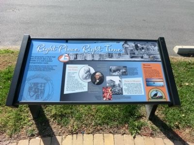
Right Place, Right Time
Photographed by Don Morfe, October 27, 2013
1. Right Place, Right Time Marker
The geography of Rock Hall puts it smack dab in the middle of a well-traveled transportation route.
From the beginning, it served as a key ferry terminus linking the Eastern and Annapolis shores. Our nation’s founding fathers, traveling frequently between the Chesapeake region and Philadelphia, passed through Rock Hall’s docks and Inns.
Spreading the News
Today’s computer driven world travels in megabytes per second; but in colonial times, news moved only as fast as ferries and horses could carry it. Its key location gave Rock Hall an advantage when it came to staying current; even news of the end of the Revolutionary War traveled through here on its way to Congress. Farm to Market
Just as with waterman, the many farmers of Kent County depended on Bay ships to transport their goods to the Baltimore and Philadelphia markers. The wharf at Rock Hall was the shipping center for southern Kent County during the 19th and 20th centuries.
Moving Forward
More recent transportation developments, such as the Bay Bridge and improved highways, have changed life on the Eastern Shore. On some days, you can see the Bay Bridge
this page online
[Captions:]
“..a lively little shipping village,” –Chestertown Transcript Account, April 20, 1893
Above left, Tench Tighman carried word through Rock Hall that the Revolutionary War had ended.
Above right, George Washington also passed through here in colonial times. Images courtesy iStockphoto.
At right, peaches are a signature crop of the Eastern Shore. Image courtesy iStockphoto.
Above, bringing in the day’s catch. Reprinted with permission from Images of America; Rock Hall, by Robin Kiarowski, Patricia Joan O. Hersey, and R. Jerry Kelser. Available from the publisher online at www.arcadiapublioshing.com or calling 888-313-2665.
The Chesapeake Bay Fishing Fair of 1938 brought notoriety to Rock Hall as THE place to fish. Various forms of fishing contests continue to this day. Reprinted with permission from Images of America; Rock Hall, by Robin Kiarowski, Patricia Joan O. Hersey, and R. Jerry Kelser. Available from the publisher online at www.arcadiapublioshing.com or calling 888-313-2665.
Erected by Chesapeake Country National Scenic Byway.
Topics. This historical marker

Photographed by Devry Becker Jones (CC0), June 13, 2026
2. Right Place, Right Time Marker
Unfortunately the marker has weathered, although it remains generally legible.
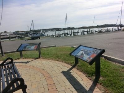
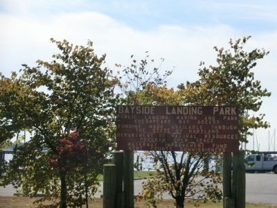
Location. 39° 8.111′ N, 76° 14.885′ W. Marker is in Rock Hall, Maryland, in Kent County. It is on Bayside Avenue. The marker is located in Bayside Landing Park. Touch for map. Marker is in this post office area: Rock Hall MD 21661, United States of America. Touch for directions.

Regionally, this marker is on the Eastern Shore. It is also in the American Mid-Atlantic, on the Delmarva Peninsula, in the Tidewater, in the Chesapeake Bay Region, and on the Eastern Seaboard. Globally, it is in the North Atlantic Region, North America, the Western Hemisphere, the Western World, and the Anglosphere. Historically, it finds itself in what was once one of the original Thirteen Colonies and also the Antebellum South.
Other nearby markers. At least 8 other markers are within walking distance of this marker: Attracted By Bounty (here, next to this marker); Bounty Below (here, next to this marker); Rock Hall Landing (approx. 0.3 miles away); Red Nun #6 (approx. 0.4 miles away); A Diversion
Photographed by Don Morfe, October 27, 2013
3. Right Place, Right Time Marker
Photographed by Don Morfe, October 27, 2013
4. Right Place, Right Time Marker
Credits. This page was last revised on June 14, 2026. It was originally submitted on November 1, 2013, by Don Morfe of Baltimore, Maryland. This page has been viewed 642 times since then and 25 times this year. Photos: 1. submitted on November 1, 2013, by Don Morfe of Baltimore, Maryland. 2. submitted on June 14, 2026, by Devry Becker Jones of Washington, District of Columbia. 3, 4. submitted on November 1, 2013, by Don Morfe of Baltimore, Maryland. • Bill Pfingsten was the editor who published this page.
