Near Ramsey in Anoka County, Minnesota — The American Midwest (Upper Plains)
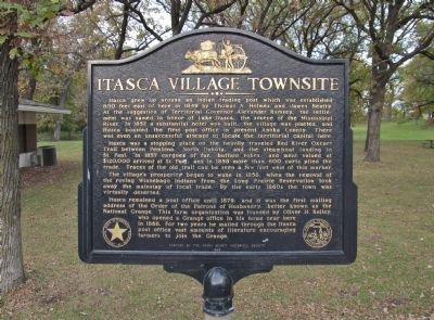
Itasca Village Townsite
Itasca was a stopping place on the heavily traveled Red River Oxcart Trail between Pembina, North Dakota, and the steamboat landing in St. Paul. In 1857 cargoes of fur, buffalo robes, and meat valued at $120,000 arrived at St. Paul, and in 1858 more than 600 carts plied the trade. Traces of the old trail can be seen a few feet west of this marker.
The village's prosperity began to wane in 1856, when the removal of the roving Winnebago Indians from the Long Prairie Reservation took away the mainstay of local trade. By the eary 1860s the town was virtually deserted.
Itasca remained a post office until 1879, and it was the first mailing address of the Order of the Patrons of Husbandry, better known as the National Grange. This farm organization was founded by Oliver H. Kelley, who opened a Grange office in his home near here in 1868. For two years he mailed through the Itasca post office vast amounts of literature encouraging farmers to join the Grange.
seal of The Minnesota Historical Society, Instituted 1849
1966
Erected 1966 by the Anoka County Historical Society. (Marker Number AN-RMC-008.)
Topics and series. This historical marker is listed in these topic lists: Agriculture • Native Americans • Roads & Vehicles • Settlements & Settlers. In addition, it is included in the Minnesota Historical Society, and the Postal Mail and Philately series lists. A significant historical year for this entry is 1849.
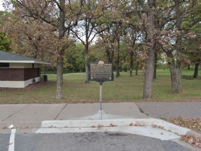
Location. 45° 14.765′ N, 93° 30.264′ W. Marker is near Ramsey, Minnesota, in Anoka County. Marker is on U.S. 10, 0.8 miles east of Cleveland Street, on the right when traveling east. Marker is in the eastbound Dayton Port Rest Area / Itasca Wayside along the Mississippi River. Touch for map. Marker is at or near this postal address: 95511 US Highway 10, Anoka MN 55303, United States of America. Touch for directions.
Other nearby markers. At least 8 other markers are within 7 miles of this marker, measured as the crow flies. Ice Age Souvenir (within shouting distance of this marker); Grange Shrine (approx. 1.8 miles away); Geology of the Elk River Region (approx. 4.2 miles away); Aaron Greenwald (approx. 6.3 miles away); Windego Park Auditorium (approx. 6.4 miles away); Washburn Saw Mill (approx. 6.4 miles away); Rum River Dam (approx. 6.4 miles away); Perseverance Needed (approx. 6.4 miles away).
Also see . . .
1. Minnesota Department of Transportation. Historic Roadside Development Structures Inventory. "The townsite of Itasca was platted on the rest area site in 1852. It competed for trade with the thriving village of Dayton, which was located on the western bank of the river and was linked to Itasca by ferry." (Submitted on November 2, 2013.)
2. Highway 10 Overlook. National Park Service. "The first government wagon road was established in 1852 leading from Point Douglas (near Hastings) through Saint Paul, Saint Anthony, Anoka and beyond. A fragment of this oxcart trail remains in the western and southern portions of the rest area." (Submitted on November 2, 2013.)
Credits. This page was last revised on June 16, 2016. It was originally submitted on November 2, 2013, by Keith L of Wisconsin Rapids, Wisconsin. This page has been viewed 1,255 times since then and 95 times this year. Photos: 1, 2, 3, 4. submitted on November 2, 2013, by Keith L of Wisconsin Rapids, Wisconsin.


