Historic South Hill in Lexington in Fayette County, Kentucky — The American South (East South Central)
Methodism in Lexington / First United Methodist Church
— United Methodist Church Registered Historic Site No. 480 —
(obverse)
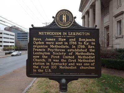
Methodism in Lexington
Revs. James Haw and Benjamin Ogden were sent in 1786 to Ky. to organize Methodists. In 1789, Rev. Francis Poythress established the Lexington Society of Methodists, now the First United Methodist Church. It was the first Methodist station in Kentucky and was one of the first 100 Methodist churches in the U.S.
(reverse)
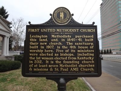
First United Methodist Church
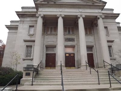
Lexington Methodists purchased this land, and, in 1840-41, built their new church. The sanctuary, built in 1907, is the 4th house of worship here. Five of its ministers were elected as bishops, including the 1st woman elected from Kentucky in 2012. It is the founding church of at least seven Methodist churches & missions & St. Paul AME Church.
Erected 2013 by Kentucky Historical Society & Kentucky Department of Highways. (Marker Number 2414.)
Topics and series. This historical marker is listed in these topic lists: Churches & Religion • Colonial Era • Settlements & Settlers. In addition, it is included in the African Methodist Episcopal (AME) Church, the Kentucky Historical Society, and the United Methodist Church Historic Sites series lists. A significant historical year for this entry is 1786.
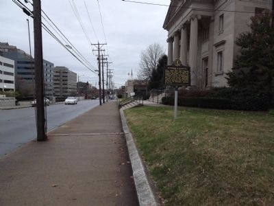
Location. 38° 2.776′ N, 84° 30.013′ W. Marker is in Lexington, Kentucky, in Fayette County. It is in Historic South Hill. Marker is at the intersection of West High Street (Kentucky Route 1974) and South Upper Street, on the left when traveling east on West High Street. Touch for map. Marker is at or near this postal address: 200 W High St, Lexington KY 40507, United States of America. Touch for directions.
Other nearby markers. At least 8 other markers are within walking distance of this marker. Rokeby Hall (about 300 feet away, measured in a direct line); Oldest House in Lexington (about 300 feet away); Jefferson Davis (about 500 feet away); Peaceful Protests for Equality / Turning a Blind Eye to a Movement (about 700 feet away); First Race Course (about 800 feet away); Fayette County (about 800 feet away); Fayette County World War I Memorial (about 800 feet away); Fayette National Bank Building (about 800 feet away). Touch for a list and map of all markers in Lexington.
Credits. This page was last revised on August 19, 2023. It was originally submitted on November 18, 2013, by Ken Smith of Milan, Tennessee. This page has been viewed 626 times since then and 21 times this year. Last updated on November 19, 2013, by Ken Smith of Milan, Tennessee. Photos: 1, 2, 3, 4. submitted on November 18, 2013, by Ken Smith of Milan, Tennessee. • Al Wolf was the editor who published this page.


