Ayden in Pitt County, North Carolina — The American South (South Atlantic)
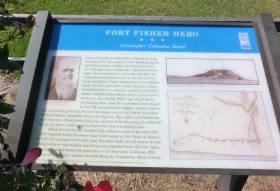
Fort Fisher Hero
Christopher Columbus Bland
Photographed by Don Morfe, September 26, 2013
1. Fort Fisher Hero Marker
Bland survived the day unscathed but suffered a wound in the ankle from
this page online
The funding for this project was provided by the North Carolina Department of Transportation through the Transportation Enhancement Program of the Federal Transportation Efficiency Act for the 21st Century.
(captions)
(upper left) Christopher C. Bland Courtesy Bill Bland
(upper right) Mound Battery, Fort Fisher, with flagpole - Courtesy Library of Congress
Erected by North Carolina Civil War Trails.
Topics and series. This historical marker is listed in these topic lists: Cemeteries & Burial Sites • War, US Civil. In addition, it is included in the North Carolina Civil War Trails, and the Sons of Confederate Veterans/United Confederate Veterans series lists. A significant historical month for this entry is January 1812.
Location. 35° 29.088′ N,
Photographed by Don Morfe, September 26, 2013
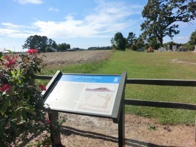
2. Fort Fisher Hero Marker

Regionally, this marker is in North Carolina’s Coastal Plain. It is also in the American South, specifically in the Upper South, and on the Eastern Seaboard. Globally, it is in the North Atlantic Region, North America, the Western Hemisphere, the Western World, and the Anglosphere. Historically, it finds itself in what was once the territory of the Mississippian Culture, one of the original Thirteen Colonies, one of the Confederate States of America, and the Antebellum South.
Other nearby markers. At least 8 other markers are within 8 miles of this marker, measured as the crow flies: Haddocks Crossroads (approx. 1.3 miles away); Former Colleges (approx. 2½ miles away); Washington's Southern Tour (approx. 2.6 miles away); Veteran's Memorial (approx. 2.9 miles away); Red Banks Church (approx. 6.3 miles away); a different marker
Photographed by Don Morfe, September 26, 2013
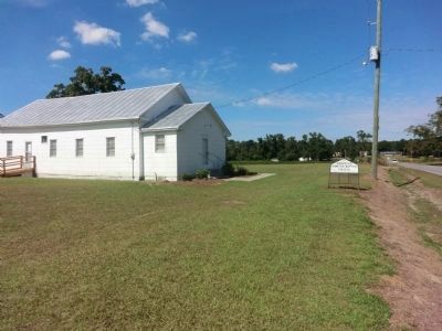
3. Hancock's Primitive Baptist Church
The Fort Fisher Hero marker is located on the grounds of this church.
Other markers no longer nearby. Red Banks Church (was approx. 6.3 miles away but has been replaced with another marker now near it); Scuffleton Bridge (was approx. 6½ miles away but has been replaced with another marker now near it).
Credits. This page was last revised on June 16, 2016. It was originally submitted on November 27, 2013, by Don Morfe of Baltimore, Maryland. This page has been viewed 1,348 times since then and 68 times this year. Photos: 1, 2, 3. submitted on November 27, 2013, by Don Morfe of Baltimore, Maryland. • Bernard Fisher was the editor who published this page.
