Amherstburg in Essex County, Ontario — Central Canada (North America)
Indian Council House
Indian Council House
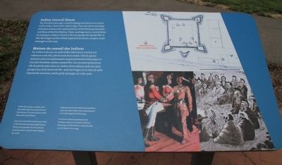
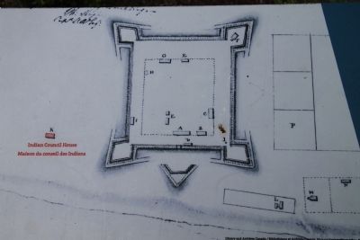
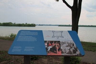
Two hundred years ago a small building stood about 100 metres north of here, close to the water's edge. This was where meetings took place between the representatives of the British government and those of the First Nations. These meetings were a crucial factor in creating an alliance between the two groups during the War of 1812. No images survive of this important structure, except a small rectangle on this map.
In this 20th-century recreation, Chief Tecumseh meets General Isaac Brock for the first time. This event may have taken place at the Council House.
Meetings between First Nations representatives and senior British officers were conducted with a formality suggested by this image.
Maison du conseil des Indiens
Il y deux cents ans, un petit édifice était situé à environ 100 mètres au nord d'ici, près du bord de la rivière. C'est là que les réunions entre les représentants du gouvernement britannique et ceux des Premières nations avaient lieu. Ces réunions jouèrent un rôle de premier plan dans la création d'une alliance entre les deux groupes lors de la Guerre de 1812. Aucune image n'a survécu de cette importante structure, sauf le petit rectangle sur cette carte.
Dans cette reproduction datant du 20 siècle, le chef Tecumseh rencontre le général Isaac Brock pour la première fois. Il se peut que cet événement se soit passé dans la Maison du conseil.
Les réunions entre les représentants des Premiè res nations et les officiers supérieurs britanniques se déroulaient en toute formalité, comme l'illustre cette image.
Erected by Parks Canada.
Topics. This historical marker is listed in these topic lists: Native Americans • War of 1812. A significant historical year for this entry is 1812.
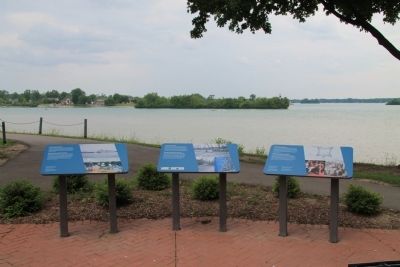
Location. 42° 6.471′ N, 83° 6.836′ W. Marker is in Amherstburg, Ontario, in Essex County. Marker can be reached from Laird Avenue South just south of Elm Avenue, on the right when traveling south. This historical marker is located in a cluster of three markers, situated a short distance behind the Fort Malden National Historic Site Visitor Centre, slightly downstream, very near the Detroit River. Touch for map. Marker is in this post office area: Amherstburg ON N9V 1X5, Canada. Touch for directions.
Other nearby markers. At least 8 other markers are within walking distance of this marker. Shoreline Breakwall (here, next to this marker); Detroit River Heritage (here, next to this marker); Pensioner's Cottage (within shouting distance of this marker); Major John Richardson (within shouting distance of this marker); Fort Malden Points of Interest
(within shouting distance of this marker); The "Tecumseh Stone" (within shouting distance of this marker); Fort Defences (about 90 meters away, measured in a direct line); The Site Over Time (about 90 meters away). Touch for a list and map of all markers in Amherstburg.
Photographed By Dale K. Benington, June 15, 2013
9. Indian Council House Marker
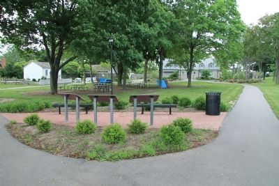
View of the backside of the featured historical marker, situated to the left of a cluster of three markers, with a distant view of the Fort Malden National Historic Site Visitor Centre at the end of the right walkway, and a distant view of the pensioner's cottage at the end of the left walkway.
Credits. This page was last revised on June 16, 2016. It was originally submitted on January 8, 2014, by Dale K. Benington of Toledo, Ohio. This page has been viewed 648 times since then and 31 times this year. Photos: 1, 2, 3, 4, 5, 6, 7, 8, 9. submitted on January 8, 2014, by Dale K. Benington of Toledo, Ohio.
