Near Burt in County Donegal, Ulster, Ireland — North West ((Éire) North Atlantic Ocean)
Grianan Ailligh / Grianán Ailigh
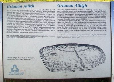
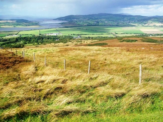
This large stone-walled fort, located on a hilltop commanding views over Loughs Foyle and Swilly and counties Donegal, Derry and Tyrone, was the royal citadel of the northern Uí Néill from the 5th to the 12th century. It was probably built some time around the birth of Christ. Its builders may have been attracted to this hilltop site by the presence here of a sacred monument - a prehistoric burial mound or tumulus, possibly from the Neolithich period (about 3000 BC).
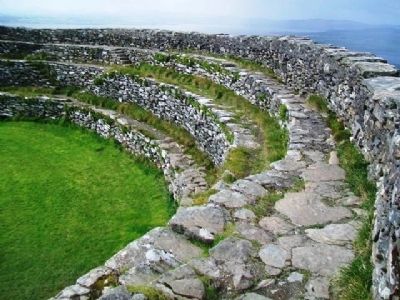
A lintelled passage through the 4.5m thick wall leads to the interior where the wall rises in three terraces to a height of about 5m; there are also two long passages contained within the thickness of the wall. Substantial restoration work was carried out in 1870. We know little about the three earthen banks which circle the Grianan, but they could be part of an earlier Bronze Age or Iron Age hillfort. The trackway running through these banks and leading to the fort is believed to be an ancient roadway.
Bhí an caiseal seo, suite ar bharr cnoic óna bhfuil ardradharc ar Loch Feabhail agus Loch Súilí agus isteach i gCo. Dhún na nGall, Co. Dhoire agus Co. Thír Eoghain, bhí sé mar dhún ríoga ag Uí Néill an Tuaiscirt ón 5ú go dtí an 12ú haois. Tógadh é thart ar aimsir Chríost. B'fhéidir gur roghnaigh an dream a thóg é an barrchnoc seo toisc go raibh leacht naofa ann cheana féin - carn adhlactha (tumulus) ó thréimhse na réamhstaire, b'fhéidir ón tréimhse neoiliteach (timpeall 3000 r. Chr.).
Tá pasáiste le fardoras ag gabháil tríd an balla (atá 4.5 m. i dtiús) isteach i gcroílár an chaisil, áit a n-éiríonn an bhalla ina thrí chéim anairde go dtí 5 m. Tá, freisin, dhá phasáiste fada laistigh den mballa féin. Rinneadh athchóiriú mór ar an gcaiseal sa bhliain 1870. Ní fheadar mórán mar gheall ar na trí mhóta de chréafóig atá thart timpeall ar an nGrianán, ach tá seans ann gur páirt iad de dhún a bhí ann roimhe sin, sa Ré Chré-umha nó sa Ré Iarainn. Creidtear gur seanbhóthar a bhí sa chosán a ghabhann tríd na mótaí seo i dtreo an chaisil.
Erected by The Office of Public Works/Oifig na nOibreacha Poiblí.
Topics. This historical marker is listed in these topic lists: Anthropology & Archaeology • Forts and Castles • Man-Made Features • Settlements & Settlers.
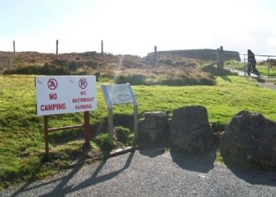
Location. 55° 1.476′ N, 7° 25.604′ W. Marker is near Burt, Ulster, in County Donegal. Marker is at the site's parking lot, about 2000 meters due south of St. Aengus' Church (AKA Burt Chapel), off Route N13 in Burt. Follow the signs. Touch for map. Touch for directions.
Other nearby markers. At least 8 other markers are within 8 kilometers of this marker, measured as the crow flies. Bloody Sunday (approx.
7.1 kilometers away in United Kingdom); The Peace Process (approx. 7.1 kilometers away in United Kingdom); The Bloody Sunday Commemoration (approx. 7.1 kilometers away in United Kingdom); Bernadette (approx. 7.1 kilometers away in United Kingdom); The Petrol Bomber (approx. 7.1 kilometers away in United Kingdom); Motorman (approx. 7.1 kilometers away in United Kingdom); Death of Innocence (approx. 7.1 kilometers away in United Kingdom); Free Derry Corner (approx. 7.1 kilometers away in United Kingdom).
Also see . . .
1. Grianan Aileach (Grainan Ailligh), Burt. (Submitted on January 24, 2014, by William Fischer, Jr. of Scranton, Pennsylvania.)
2. Grianan of Aileach Ring Fort (Grianan Ailigh). (Submitted on January 25, 2014, by William Fischer, Jr. of Scranton, Pennsylvania.)
Credits. This page was last revised on December 3, 2020. It was originally submitted on January 24, 2014, by William Fischer, Jr. of Scranton, Pennsylvania. This page has been viewed 517 times since then and 2 times this year. Photos: 1, 2, 3, 4. submitted on January 25, 2014, by William Fischer, Jr. of Scranton, Pennsylvania.


