Donegal Town in County Donegal, Ulster, Ireland — North West ((Éire) North Atlantic Ocean)
Donegal Friary / Mainistir Dhún na nGall
Inscription.
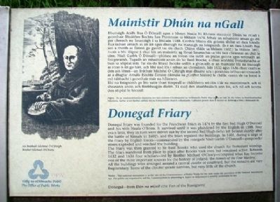
Donegal Friary was founded for the Franciscan Friars in 1474 by the first Red Hugh O'Donnell and his wife Nuala O'Brien. It survived until it was plundered by the English in 1588. Four years later, they in turn were driven out by the second Red Hugh (who left Ireland shortly after the battle of Kinsale in 1602), and the friars repaired the buildings. In 1601, during a siege of the friary by English forces - commanded by the renegade Niall Garbh O'Donnell - gunpowder stores exploded and wrecked the building.
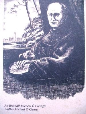
The friary was then granted to Sir Basil Brooke who used the church for Protestant worship. The friars wandered from place to place after Brooke took over, but remained active. Between 1632 and 1636 four scholars - led by Brother Michael O'Cleary - compiled what has become one of the most important sources for the history of Ireland: the Annals of the Four Masters.
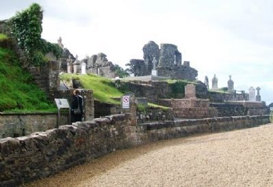
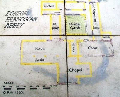
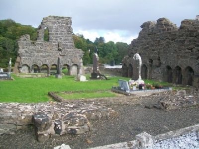
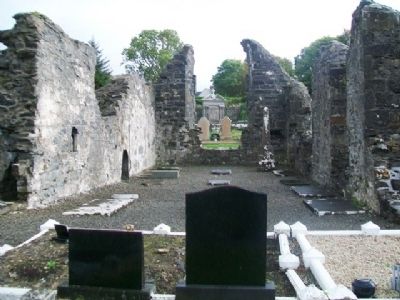
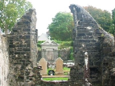
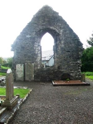
All the buildings were arranged around a central cloister or courtyard, but the remains are very fragmentary. Some of the cloister arcade survives, but very little of the church.
Donegal - from Dún na nGall (the Fort of the Foreigners)
————————
Bhunaigh Aodh Rua Ó Dónaill agus a bhean Nuala Ní Bhriain mainistir Dhún na nGall i gcomhair Bhráithre Bochta San Phroinsias sa bhliain 1474. Mhair an mhainistir anuas go dtí gur chreach na Sasanaigh i sa bhliain 1588. Ceithre bliana dár gcionn dhíbir an dara hAodh Rua iadsan amach as an áit agus dheisigh na manaigh na foirgnimh. (Is é an dara hAodh Rua seo a theith as Éirinn go gairid tar éis chath Chinn tSáile sa bhliain 1602.) Sa bhliain 1601, nuair a bhí léigear á shuí leis an mainistir ag fórsaí Sasanacha - a bhí faoi cheannas an chúl le cine, Niall Garbh Ó Dónaill - phléasc an stóras ina raibh an púdar gunna agus scriosadh an foirgneamh. Tugadh an mhainistir ansin do Sir Basil Brooke, a chuir seirbhísí Protastúnacha ar bun sa séipéal inti. Tar éis do Bhasil Brooke seilbh a ghlacadh ar an mainistir bhí na manaigh ar strae ó áit go háit, ach bhí siad fós i mbun an chreidimh. Idir 1632 agus 1636 chuir ceathrar den aos léinn - an Bráthair Míchéal Ó Cléirigh mar dhuine acu i gceannas orthu - an cnuasach ar a dtugtar Annála Ríochta Éireann (Annála na gCeithre Máistrí) le chéile, ceann de na foinsí is mó tábhacht i gcomhair stair na hÉireann.
Bhí na foirgnimh go léir suite thart timpeall ar chlabhstra nó clós i lár na mainistreach, ach ní sheasann anois ach fíorbheagán díobh. Tá cuid den stuabhealach ann fós, ach níl ach iarsma den séipeál le feiceáil.
Erected by The Office of Public Works.
Topics. This historical marker is
listed in these topic lists: Cemeteries & Burial Sites • Churches & Religion • Disasters • Man-Made Features. A significant historical year for this entry is 1474.
Location. 54° 39.047′ N, 8° 6.897′ W. Marker is in Donegal Town, Ulster, in County Donegal. Marker is along the River Eske walkway, off Quay Street (R267). Touch for map. Touch for directions.
Other nearby markers. At least 7 other markers are within 19 kilometers of this marker, measured as the crow flies. The Franciscan Friary of Donegal (within shouting distance of this marker); "The Frenchman's Anchor" (approx. 0.3 kilometers away); Donegal Castle / Caisleán Dhún na nGall (approx. half a kilometer away); Donegal Castle (approx. half a kilometer away); Welcome to Belleek (approx. 19.1 kilometers away in United Kingdom); Donegal Corridor (approx. 19.2 kilometers away in United Kingdom); The Enamel Grindstone (approx. 19.2 kilometers away in United Kingdom).
Also see . . . Franciscan Friary, Donegal Town, Ireland. (Submitted on February 6, 2014, by William Fischer, Jr. of Scranton, Pennsylvania.)
Credits. This page was last revised on July 24, 2018. It was originally submitted on February 5, 2014, by William Fischer, Jr. of Scranton, Pennsylvania. This page has been viewed 478 times since then and 3 times this year. Photos: 1, 2, 3, 4, 5, 6. submitted on February 6, 2014, by William Fischer, Jr. of Scranton, Pennsylvania. 7, 8. submitted on February 7, 2014, by William Fischer, Jr. of Scranton, Pennsylvania.
