Kula in Maui County, Hawaii — Hawaiian Island Archipelago (Pacific Ocean)
Haleakalā National Park
Summit District
Photographed by Don Morfe, November 6, 2008
1. Haleakala National Park Marker
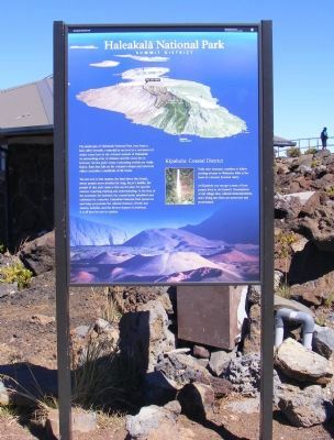
You are now in kua mauna, the land above the clouds, where people never dwelled for long. Ka po‘e kahiko, the people of old, only came to this sacred place for specific reasons requiring training and understanding. At the foot of the mountain lies kahakai, the costal lands, inhabited and cultivated for centuries. Haleakala National Park preserves and helps perpetuate the cultural richness of both kua mauna, kahakai, and the diverse features in between. It is all here for you to explore.
Kīpahulu Costal District. Trails skirt dramatic coastline or follow pooling streams to Waimoku Falls at the head of a densely forested valley. At Kīpahulu you can get a sense of how people lived in old Hawai‘i. Foundations of old
this page online
Erected by National Park Service-United States Department of the Interior.
Topics. This historical marker is listed in these topic lists: Natural Features • Notable Places.
Location. 20° 42.882′ N, 156° 15.036′ W. Marker is in Kula, Hawaii, in Maui County. It is on Crater Road. The marker is located at the Red Hill Summit Observation and Exhibition Building. Touch for map. Marker is in this post office area: Kula HI 96790, United States of America. Touch for directions.

Regionally, this marker is in Upcountry Maui. Globally, it is in North America, in Polynesia, in the Pacific Ocean, in North Pacific, on the Pacific Rim, in the Western Hemisphere, in the Western World, and in the Anglosphere.
Other nearby markers. At least 8 other markers are within 11 miles of this marker, measured as the crow flies: Pa Ka‘oao (about 400 feet away, measured in a direct line); Ranch Wall (approx. 2.4 miles away); Behold, Hawai'i (approx. 3.1 miles away); Hawaiian Goose or Nene (Nay-Nay)

Photographed by Don Morfe, November 6, 2008
2. Haleakala National Park Visitor Center
Photographed by Don Morfe, November 6, 2008
3. Haleakala National Park - Summit Area
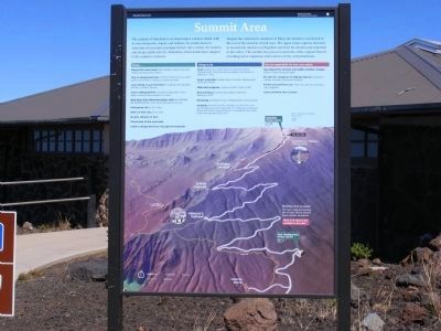
The summit of Halaekala is an island atop a volcanic island, with its own distinctive climate and habitats. Its cinder desert is sometimes frozen and seemingly barren. Yet a variety of creatures and unique plants like the ahinahina (silversword) have adapted to the summit’s extremes. Despite the contracts to seashores of Maui, the summit is connected to the rest of the island in critical ways. The upper slopes capture moisture to nourish the rainforest of Kipahulu and feed the streams and waterfalls in the valleys. The summit also preserves portions of the original Hawai’i including native vegetation and evidence of the early inhabitants.
Photographed by Don Morfe, November 6, 2008
4. Summit Visitor Center
Photographed by Don Morfe, November 6, 2008
5. View from the Visitor Center
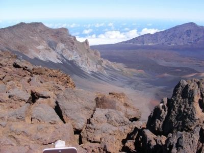
Photographed by Don Morfe, November 6, 2008
6. View from the Visitor Center
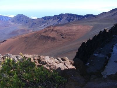
Photographed by Don Morfe, November 6, 2008
7. View from the Visitor Center
Credits. This page was last revised on April 15, 2026. It was originally submitted on February 14, 2014, by Don Morfe of Baltimore, Maryland. This page has been viewed 863 times since then and 30 times this year. Photos: 1, 2, 3, 4, 5, 6, 7. submitted on February 14, 2014, by Don Morfe of Baltimore, Maryland. • Bill Pfingsten was the editor who published this page.
