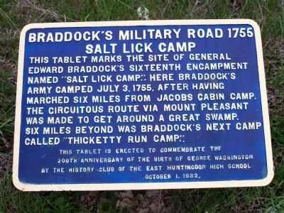
Braddock's Military Road 1755 Salt Lick Camp
This tablet is erected to commemorate the 200th Anniversary of the Birth of George Washington by the History Club of the East Huntingdon High School October 1, 1932.
Erected 1932 by History Club of the East Huntingdon High School.
Topics and series. This historical marker is listed in these topic lists: Colonial Era • Settlements & Settlers • War, French and Indian. In addition, it is included in the Braddock’s Road and Maj. Gen. Edward Braddock series list. A significant historical date for this entry is July 3, 1755.
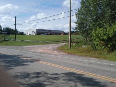
Location. 40° 11.602′ N, 79° 35.467′ W. Marker is near Hempfield, Pennsylvania, in Westmoreland County. Marker is on S Center Ave (Pennsylvania Route 3093) 2 miles south of Interstate 70, on the left when traveling south. The entrance to a Case Tractor Dealership is just to the left of the marker.
The marker is exactly 2 miles southeast of I-70 while travelling on S Center Ave.
Other nearby markers. At least 8 other markers are within 4 miles of this marker, measured as the crow flies. East Huntingdon Soldiers Monument (approx. 1.6 miles away); Rural Free Delivery (approx. 1.8 miles away); Morewood Massacre (approx. 3.4 miles away); Braddock's Military Road 1755 (approx. 3˝ miles away); General Edward Braddock and His Army (approx. 3˝ miles away); Standard Shaft Mine and Coke Works (approx. 3.6 miles away); Henry Clay Frick (approx. 3.8 miles away); War Memorial (approx. 3.8 miles away).
More about this marker. The marker is low to the ground but there is space to pull over and get out to read it.
Regarding Braddock's Military Road 1755 Salt Lick Camp. Braddock's senior officers held a council of war on July 3-4, 1755. Despite strong opposition, the council made the fateful decision to press on to Fort Duquesne without waiting for Colonel Dunbar's troops to catch up with Colonel Halkett's army.
Credits. This page was last revised on June 16, 2016. It was originally submitted on April 15, 2012, by Andrew Capets of Irwin, Pennsylvania. This page has been viewed 1,440 times since then and 60 times this year. Last updated on March 17, 2014, by Jay Stern of Connellsville, Pennsylvania. Photos: 1. submitted on April 15, 2012, by Andrew Capets of Irwin, Pennsylvania. 2. submitted on July 30, 2013, by Jay Stern of Connellsville, Pennsylvania. • Bill Pfingsten was the editor who published this page.

