Office Hall in King George County, Virginia — The American South (Mid-Atlantic)
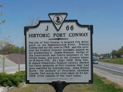
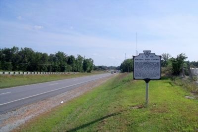
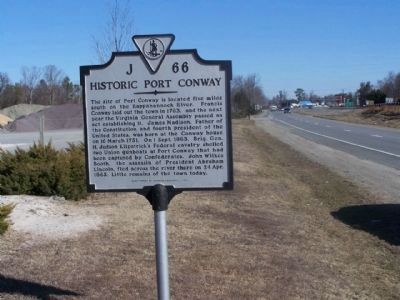
Historic Port Conway
Erected 1999 by Department of Historic Resources. (Marker Number J-66.)
Topics and series. This historical marker is listed in these topic lists: Settlements & Settlers • War, US Civil • Waterways & Vessels. In addition, it is included in the Booth's Escape, the Former U.S. Presidents: #04 James Madison, and the Virginia Department of Historic Resources (DHR) series lists. A significant historical date for this entry is March 16, 1751.
Location. 38° 14.106′ N, 77° 9.055′ W. Marker is in Office Hall, Virginia, in King George County. Marker is on US 301 James Madison Parkway, half a mile south of VA 3 Kings Highway, on the right when traveling south. Touch for map. Marker is in this post office area: King George VA 22485, United States of America. Touch for directions.
Other nearby markers. At least 8 other markers are within 4 miles of this marker, measured as the crow flies. Veterans Memorial (approx. 1.7 miles away); Hanover Baptist Church (approx. 2˝ miles away); World War I Memorial (approx. 2.7 miles away); Ralph Bunche High School (approx. 2.7 miles away); King George Confederate Monument (approx. 2.7 miles away); St. Paul’s Church (approx. 4.1 miles away); Eagle’s Nest (approx. 4.1 miles away); Marmion (approx. 4.1 miles away).
Also see . . . Booth's Escape Byway, Maryland Office of Tourism. (Submitted on August 19, 2019.)
Additional keywords. John Wilkes Booth Escape Route
Credits. This page was last revised on December 25, 2019. It was originally submitted on April 23, 2008, by Bill Pfingsten of Bel Air, Maryland. This page has been viewed 3,064 times since then and 189 times this year. Photos: 1. submitted on April 23, 2008, by Bill Pfingsten of Bel Air, Maryland. 2. submitted on September 6, 2009, by Bernard Fisher of Richmond, Virginia. 3. submitted on March 7, 2010, by Mike Stroud of Bluffton, South Carolina.


