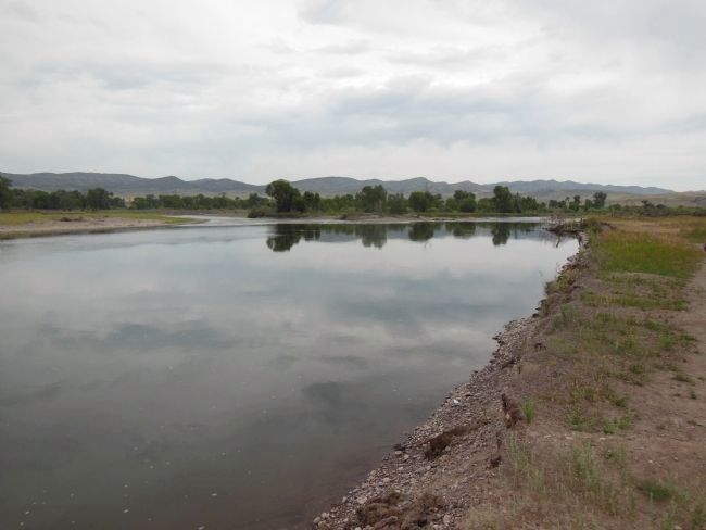
Near Three Forks in Gallatin County, Montana — The American West (Mountains)
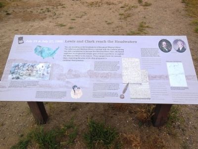
Lewis and Clark reach the Headwaters
July 25 & July 27, 1805
Clark arrived at the Headwaters first, on July 25, 1805. He quickly explored the area and then continued on, hoping to find the Shoshone and the horses they desperately needed. He returned two days later, exhausted and ill. Lewis arrived that day, and the whole party camped for 3 days while they continued to explore the area. The camp is thought to be less than a mile up the Jefferson River from here on private land.
As the party left the Headwaters, they were anxious to find the Shoshones, who they hoped would provide them with horses to continue their journey across the mountains. On August 13, 1805 the Corps met up with the Lemhi Shoshone, including Sacagawea’s brother.
On their return trip, Lewis and Clark split up to explore more of the territory north and south of the Missouri River. Clark passed through here again in the summer of 1806.
Lewis describes in his journal how they determined this to be the source of the Missouri River. They named the three tributaries the Jefferson, the Madison, and the Gallatin, after the organizers of the expedition: President Jefferson, Secretary of State James Madison, and Secretary of the Treasury, Albert Gallatin.
”Both Capt. C. and myself corrisponded in opinion with rispect to the impropriety of calling either of these streams the Missouri and accordingly agreed to name them after the President of the United States and the Secretaries of the Treasury and state…”
Meriwether Lewis, July 28, 1805
”a fine morning we proceeded on a fiew miles to the three forks of the Missouri those three forks are nearly of a Size, the North fork appears to have the most water and must be Considered as the one best calculated for us to assend…”
William Clark, July 25th, 1805
”I was verry unwell all night, Something better this morning, a very worm day untill 4 oClock when the wind rose & blew hard from the S W… Several deer killed to day men all employed dressing Skins for Clothes & Mockersons…”
William Clark, July 28, 1805
[photo captions]
• Clark’s maps of the Headwaters
Clark was the mapmaker for the expedition. He was ill during his stay at the Headwaters, with a fever and flulike symptoms.
Topics and series. This historical marker is listed in these topic
lists: Exploration • Native Americans • Waterways & Vessels. In addition, it is included in the Lewis & Clark Expedition series list. A significant historical date for this entry is July 25, 1805.
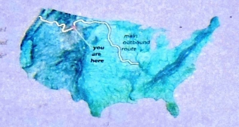
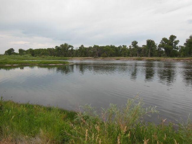
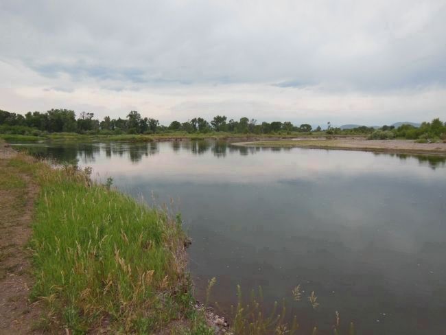
Location. 45° 55.591′ N, 111° 30.25′ W. Marker is near Three Forks, Montana, in Gallatin County. Marker can be reached from Trident Road. Marker is located inside the Missouri Headwaters State Park, overlooking the point where the Madison and Jefferson rivers converge to form the Missouri river. Touch for map. Marker is in this post office area: Three Forks MT 59752, United States of America. Touch for directions.
Other nearby markers. At least 8 other markers are within 2 miles of this marker, measured as the crow flies. The Naming of a River (within shouting distance of this marker); Jefferson’s Instructions to Lewis and Clark (about 300 feet away, measured in a direct line); Thomas-Frederick Flour Mill (approx. half a mile away); The Log Cabin (approx. half a mile away); Colter’s Run (approx. half a mile away); Second Gallatin City (approx. half a mile away); Gallatin City Hotel - 1868 (approx. 0.6 miles away); The Upper Missouri (approx. 1.1 miles away). Touch for a list and map of all markers in Three Forks.
More about this
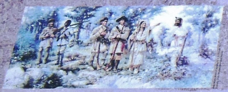
3. Marker detail: 1912 Painting by E.S. Paxson
This painting, done in 1912 by E.S. Paxson shows Sacagawea, a Shoshone woman indicating to Lewis and Clark that she recognizes the landscape from her childhood. This gave the Corps renewed hope that they could find the Shoshone people and the horses they needed.
Also see . . .
1. Missouri Headwaters State Park.
Lewis and Clark visited the site on July 28, 1805. Meriwether Lewis in his journal entry wrote: "Both Capt. C. and myself corresponded in opinon with respect to the impropriety of calling either of these streams the Missouri and accordingly agreed to name them after the President of the United States and the Secretaries of the Treasury and State." (Submitted on May 9, 2014, by Cosmos Mariner of Cape Canaveral, Florida.)
2. Three Forks of the Missouri. On July 25, 1805, the expedition finally reached the headwaters of the Missouri River. It was here that Sacagawea had previously been kidnapped by the Hidatsa during a raid on a Shoshone camp. The confluences of the Three Forks of the Missouri join along the boundary between Broadwater and Gallatin counties, about three miles northeast of the town of Three Forks and within the Missouri Headwaters State Park. (Submitted on April 5, 2021, by Cosmos Mariner of Cape Canaveral, Florida.)
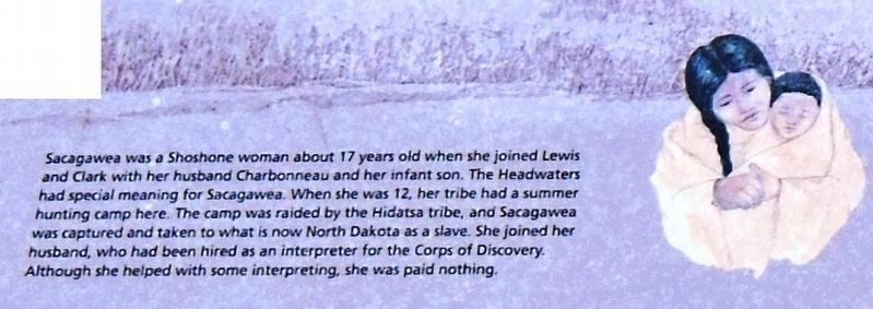
4. Marker detail: Sacagawea
Sacagawea was a Shoshone woman about 17 years old when she joined Lewis and Clark with her husband Charbonneau and her infant son. The Headwaters had special meaning for Sacagawea. When she was 12, her tribe had a summer hunting camp here. The camp was raided by the Hidatsa tribe, and Sacagawea was captured and taken to what is now North Dakota as a slave. She joined her husband, who had been hired as an interpreter for the Corps of Discovery. Although she helped with some interpreting, she was paid nothing.
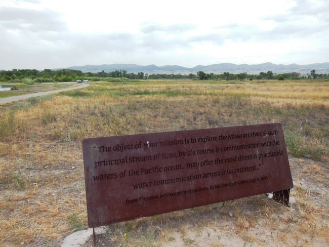
Photographed By Cosmos Mariner, July 11, 2013
5. The Objective of Your Mission...
from Thomas Jefferson's instructions to Meriwether Lewis, July 4, 1803
Credits. This page was last revised on April 5, 2021. It was originally submitted on May 8, 2014, by Cosmos Mariner of Cape Canaveral, Florida. This page has been viewed 1,082 times since then and 70 times this year. Photos: 1. submitted on May 8, 2014, by Cosmos Mariner of Cape Canaveral, Florida. 2, 3, 4. submitted on April 4, 2021, by Cosmos Mariner of Cape Canaveral, Florida. 5. submitted on May 9, 2014, by Cosmos Mariner of Cape Canaveral, Florida. 6. submitted on May 8, 2014, by Cosmos Mariner of Cape Canaveral, Florida. 7, 8. submitted on May 9, 2014, by Cosmos Mariner of Cape Canaveral, Florida. • Bill Pfingsten was the editor who published this page.
