Stearns in McCreary County, Kentucky — The American South (East South Central)
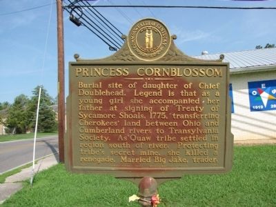
Princess Cornblossom
Erected 1967 by Kentucky Historical Society/Kentucky Department of Highways. (Marker Number 1075.)
Topics and series. This historical marker is listed in these topic lists: Cemeteries & Burial Sites • Native Americans • Settlements & Settlers • Women. In addition, it is included in the Kentucky Historical Society series list. A significant historical year for this entry is 1775.
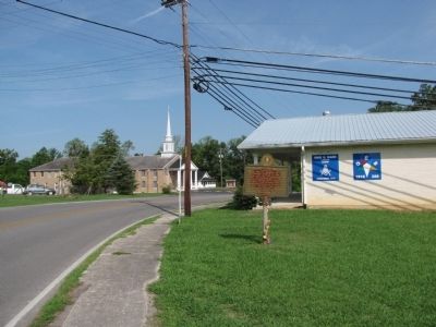
Location. 36° 41.979′ N, 84° 28.834′ W. Marker is in Stearns, Kentucky, in McCreary County. Marker is at the intersection of Kentucky Route 1651 and Kinne Street, on the left when traveling south on State Route 1651. Marker is adjacent to the Orie S Ware Lodge #874 F&AM, just south of the Stearns First Baptist Church. Touch for map. Marker is in this post office area: Stearns KY 42647, United States of America. Touch for directions.
Other nearby markers. At least 8 other markers are within 12 miles of this marker, measured as the crow flies. Sandstone Tree Stump (approx. 0.2 miles away); Historic Stearns Kentucky (approx. 0.2 miles away); Stearns Coal & Lumber Company (approx. ¼ mile away); First Kentucky Oil Well / Martin Beaty (Beatty) (approx. 1.9 miles away); McCreary County, 1912 (approx. 1.9 miles away); Edward "Eddie" Ward (approx. 3.4 miles away); Tennessee / Kentucky (approx. 7.6 miles away in Tennessee); 4-H Craft Center (approx. 11.9 miles away). Touch for a list and map of all markers in Stearns.
Credits. This page was last revised on April 24, 2018. It was originally submitted on May 15, 2014, by Lee Hattabaugh of Capshaw, Alabama. This page has been viewed 1,535 times since then and 126 times this year. Photos: 1, 2. submitted on May 15, 2014, by Lee Hattabaugh of Capshaw, Alabama. • Bill Pfingsten was the editor who published this page.

