Near Allerton in Vermilion County, Illinois — The American Midwest (Great Lakes)
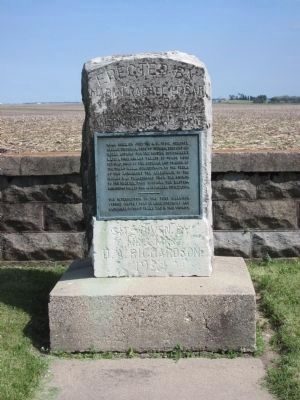
Croghan Treaty with Pontiac
July 1765
The intersection of the Fort Harrison (Terre Haute) Fort Clarke (Peoria) and Kaskaskia-Detroit trails was in this vicinity.
Site given by Mr. and Mrs. D. A. Richardson 1924
Erected 1924 by Madam Rachel Edgar Chapter Daughters of the American Revolution.
Topics and series. This historical marker is listed in these topic lists: Native Americans • War, French and Indian. In addition, it is included in the Daughters of the American Revolution series list. A significant historical month for this entry is July 1884.
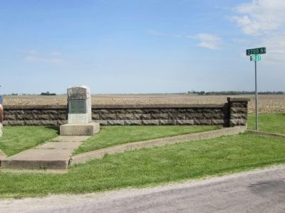
Location. 39° 51.918′ N, 87° 52.851′ W. Marker is near Allerton, Illinois, in Vermilion County. Marker is at the intersection of 2700 N and 500E Edgar County Roads, on the left when traveling west on 2700 N. sited in the NW corner of a field at the SE quadrant of the intersection of Edgar County Roads 2700N and 500 E, east of IL Route 49, a few miles southeast of Allerton. This location was known as Palermo, which can be found on Illinois highway maps. Touch for map. Marker is in this post office area: Allerton IL 61810, United States of America. Touch for directions.
Other nearby markers. At least 8 other markers are within 11 miles of this marker, measured as the crow flies. Detroit - Kaskaskia Indian Trail (approx. 2.7 miles away); Sidell Veterans War Memorial (approx. 4˝ miles away); The Streibich Blacksmith Shop (approx. 7.1 miles away); Newman Veterans Memorial (approx. 7.2 miles away); Veterans Honor Roll (approx. 8.6 miles away); Community Honor Roll of Those Who Served (approx. 9.8 miles away); Former Site of Orizaba IL (approx. 10 miles away); Site of German Lutheran Immanuel Church (approx. 10.4 miles away).
More about this marker. The large upright stone has a metal plaque affixed. Behind the stone is a fence of formed cement blocks that separates the field from the marker stone. Grass around the stone is kept mowed. Another marker along IL Route 49 south of Allerton also notes the event and marks the east-west road to this site.
Credits. This page was last revised on June 16, 2016. It was originally submitted on May 25, 2014. This page has been viewed 890 times since then and 43 times this year. Last updated on May 27, 2014. Photos: 1. submitted on May 25, 2014, by Sally Duchow of Champaign, Illinois. 2. submitted on May 25, 2014. • Bill Pfingsten was the editor who published this page.

