Vallonia in Jackson County, Indiana — The American Midwest (Great Lakes)
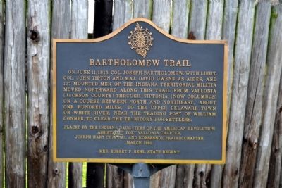
Bartholomew Trail
Erected 1991 by Indiana Daughters of the American Revolution, assisted by Fort Vallonia Chapter, Joseph Hart Chapter, and Horseshoe Prairie Chapter.
Topics and series. This historical marker is listed in these topic lists: Roads & Vehicles • Settlements & Settlers • Wars, US Indian. In addition, it is included in the Daughters of the American Revolution series list. A significant historical month for this entry is June 1812.
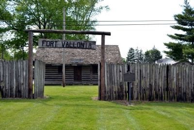
Location. 38° 50.68′ N, 86° 5.902′ W. Marker is in Vallonia, Indiana, in Jackson County. Marker can be reached from S. Main Street (County Road S310W) south of Water Street, on the right when traveling south. Marker is located next to the entry gate of the reproduction of Fort Vallonia. Touch for map. Marker is at or near this postal address: 2444 S Main St, Vallonia IN 47281, United States of America. Touch for directions.
Other nearby markers. At least 8 other markers are within 4 miles of this marker, measured as the crow flies. Site of Fort Vallonia (within shouting distance of this marker); Fort Vallonia (approx. half a mile away); Medora Covered Bridge (approx. 3.2 miles away); Driftwood Church and Cemetery (approx. 3.3 miles away); In Memory of Col. John Ketcham / Time Capsule (approx. 3.8 miles away); All Veterans Honor Roll Memorial (approx. 3.8 miles away); The Freedom Tree (approx. 3.9 miles away); Jackson County W.W. I Veterans Memorial (approx. 3.9 miles away). Touch for a list and map of all markers in Vallonia.
Credits. This page was last revised on June 16, 2016. It was originally submitted on May 29, 2014, by Duane Hall of Abilene, Texas. This page has been viewed 591 times since then and 12 times this year. Photos: 1, 2. submitted on May 29, 2014, by Duane Hall of Abilene, Texas.

