Blair in Washington County, Nebraska — The American Midwest (Upper Plains)
Steamboat Bertrand
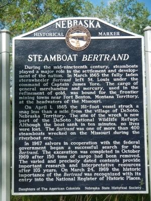
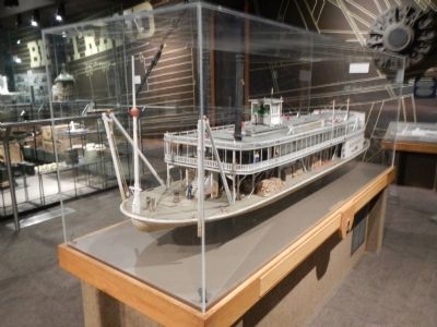
During the mid-nineteenth century, steamboats played a major role in the settlement and development of the nation. In March 1865 the fully laden sternwheeler Bertrand left St. Louis under command of Captain James Yore. The cargo of general merchandise and mercury, used in the refinement of gold, was bound for the frontier mining towns near Fort Benton, Montana Territory, at the headwaters of the Missouri.
On April 1, 1865 the 161-foot vessel struck a snag less than a mile from the village of DeSoto, Nebraska Territory. The site of the wreck is now part of the DeSoto National Wildlife Refuge. Although the boat sank in ten minutes, no lives were lost. The Bertrand was one of more than 400 steamboats wrecked on the Missouri during the riverboat era.
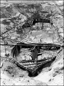
In 1967 salvors in cooperation with the federal government began a successful search for the Bertrand. The excavation was completed in October 1969 after 150 tons of cargo had been removed. The varied and precisely dated contents provide important research and interpretive resources after 103 years. On March 24, 1969 the historic importance of the Bertrand was recognized with its entry into the National Register of Historic Places.
Erected by Daughters of the American Colonists, Nebraska State Historical Society. (Marker Number 137.)
Topics and series. This historical marker is listed in these topic lists: Disasters • Waterways & Vessels. In addition, it is included in the Daughters of the American Colonists, and the Nebraska State Historical Society series lists. A significant historical month for this entry is March 1865.
Location. 41° 31.271′ N, 96° 1.794′ W. Marker is in Blair, Nebraska, in Washington County. Marker can be reached from DeSoto Avenue. Touch for map. Marker is in this post office area: Blair NE 68009, United States of America. Touch for directions.
Other nearby markers. At least 8 other markers are within 5 miles of this marker, measured as the crow flies. The Lewis and Clark Expedition (approx. 0.7 miles away); Up the Missouri (approx. 0.7 miles away); Lewis and Clark Campsite Area (approx. 1˝ miles away); DeSoto Townsite (approx. 2.7 miles away); Fort Atkinson (approx. 4˝ miles away); Lewis and Clark Campsite (approx. 4.6 miles away); The Death of Marshal Suverkrubbe (approx. 4.8 miles away); a different marker also named Fort Atkinson (approx. 4.9 miles away). Touch for a list and map of all markers in Blair.
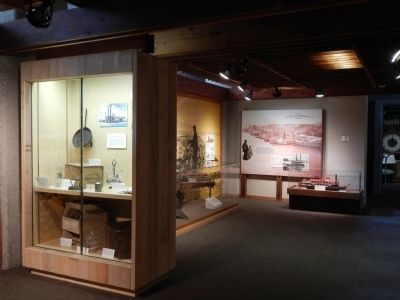
More about this marker. The Steamboat Bertrand is located on an isolated ‘island’ of the State of Nebraska created when the U.S. Army Corp of Engineers cut off the DeSoto Bend oxbow and straightened the Missouri River. Access to the DeSoto National Wildlife Refuge is gained only though the State of Iowa. The Bertrand’s artifact are on exhibit at the DeSoto National Wildlife Refuge Visitors Center.
Also see . . .
1. The Tricky Missouri River and the Steamboat Bertrand. Iowa PBS website entry:
About 25 miles north of Council Bluffs and Omaha there was a big V-shaped bend in the river. The bend was thick with snags of dead trees. Somewhere along that bend the Bertrand hit a snag. Within five minutes the boat sank. All the passengers were saved, but thousands of dollars worth of cargo was lost. (Submitted on June 3, 2014, by Barry Swackhamer of Brentwood, California.)
2. Steamboat Bertrand at DeSoto Nation Wildlife Refuge. U.S. Fish & Wildlife Service website entry:
DeSoto National Wildlife Refuge, located in Missouri Valley, Iowa, is home to a premier archeological collection of 200,000 artifacts excavated from the buried hull of the Steamboat Bertrand. In 1865 the boat hit a snag, or submerged log, twenty miles north of Omaha, Nebraska. Bound for the newly discovered goldfields of Montana from St. Louis, Missouri, the Bertrand sank into the depths of the Missouri River. Its cargo was a complete loss. Local legend indicated the ship carried whiskey, coins and 500 flasks of mercury to be used in the mining process, a treasure trove worth hundreds of thousands of dollars! (Submitted on June 3, 2014, by Barry Swackhamer of Brentwood, California.)
Additional keywords. Steamboat Bertrand
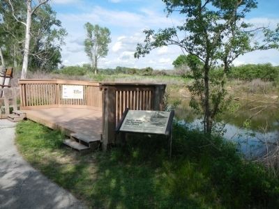
Photographed By Barry Swackhamer, May 26, 2014
5. The Bertrand Excavation Site
April 1, 1865: The Bertrand Goes Down
The Bertrand left St. Louis on March 18, 1865, on its maiden voyage up the Missouri to Fort Benton, Montana Territory. That spring saw many such departures, as steamboat owners rushed to complete the 2,000-mile journey during the high water season.
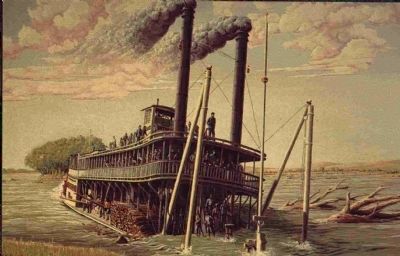
At dawn on April 1, the boat boat left Omaha and proceeded upriver, making almost 25 miles by mid-afternoon. At 3 pm the boat road up on a snag, causing the steer to swamp with water. The passengers and crew were able to scramble to safety, but the boat and its cargo sank to the bottom. Only the superstructure, pilot house and smokestacks remained above water.
Although some upper fittings were removed soon after the sinking, the shifting sediments of the river soon obliterated all traces of the steamboat.
Caption: The Missouri River, the waterway to the west, was especially treacherous because of its changing channels, shifting sandbars, and numerous snags. The Bertrand was only one of more than 400 steamboats wrecked on the Missouri during the heyday of the riverboat.
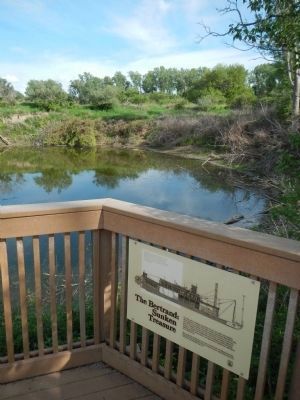
Photographed By Barry Swackhamer, May 26, 2014
6. The Bertrand Excavation Site
The Bertrand: Sunken Treasure
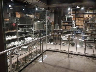
In 1969, salvors seeking a treasure of mercury, gold, and whiskey discovered the remains of the 19th century steamboat Bertrand at this site. While unsuccessful in finding the anticipated amount of mercury, gold or whiskey, the salvage crew uncovered a priceless historical treasure: mining tools, household items, clothing, preserved foods. blasting powder, ammunition, and agricultural implements still intact in the ship’s hold.
The cargo recovered from the boat is preserved and displayed in the DeSoto National Wildlife Refuge Visitor Center, administered by the U.S. Fish and Wildlife Service.
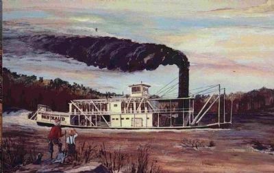
Caption: The Bertrand was a mountain steamer, built in late 1864 for the Missouri River trade to the gold fields of Montana. Its shallow hull measuring 161 feet from stem to stern was designed for navigating among the sandbars and snags of the Big Muddy.
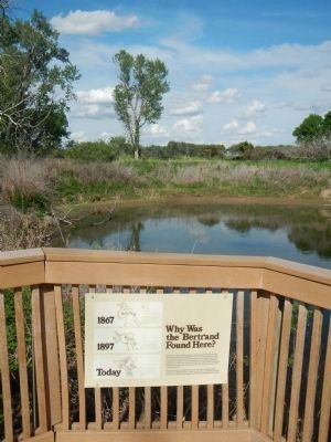
Photographed By Barry Swackhamer, May 26, 2014
7. The Bertrand Excavation Site
Why Was the Bertrand Found Here?
Until recent years, when the upstream dams reduced spring flooding, the Missouri frequently changed course. As it swept around bends, the currents cut away banks. Eroding soils were carried away and redeposited downstream. These actions often caused an existing channel to vanish - sometimes overnight - as a new channel emerged. Riverboat captains had to be always alert for channel changes that could spell disaster.
Had you been here in 1865, you would have been standing in the middle of the Missouri River. Since that time, the channel has shifted many times, leaving the buried hull of the Bertrand beneath dry land.
Captions: 1867 Two years after the Bertrand sank, Colonel John Macomb of the U.S. Army Corps of Engineers, sketched this map of the Missouri in the vicinity of DeSoto townsite; 1897 This 1897 map of the Missouri River shows a vastly different river course when compared to Macomb’s map drawn 30 years earlier.; Today Through much of the 20th century, the horseshoe of DeSoto Bend, was a prominent river feature. In the 1950s, the Corps of Engineers constructed a cutoff channel to shorten navigation distances.
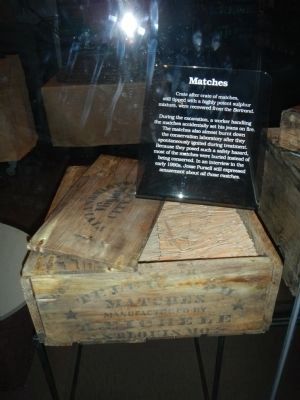
Photographed By Barry Swackhamer, May 26, 2014
12. Artifacts from the Steamboat Bertrand
Crate after crate of matches, still tipped with a highly potent sulphur mixture, were recovered from the Bertrand.
During the excavation, a worker handling the matches accidentally set his jeans on fire. The matches also almost burnt down the conservation laboratory after they spontaneously ignited during treatment. Because they posed such a safety hazard they were buried instead of being conserved. In a interview in the early 1990s, Jesse Pursell still expressed amazement about all those matches.
Credits. This page was last revised on April 22, 2022. It was originally submitted on June 3, 2014, by Barry Swackhamer of Brentwood, California. This page has been viewed 1,360 times since then and 60 times this year. Photos: 1, 2, 3, 4, 5, 6, 7, 8, 9, 10, 11, 12. submitted on June 3, 2014, by Barry Swackhamer of Brentwood, California. • Bill Pfingsten was the editor who published this page.
