Niagara Falls in Niagara County, New York — The American Northeast (Mid-Atlantic)
Goat Island
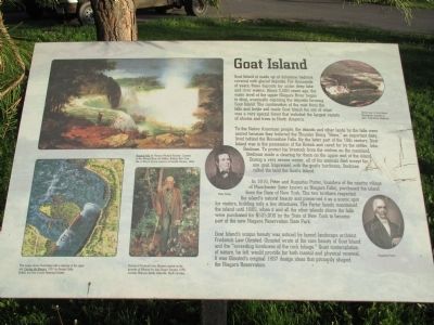
Goat Island is made up of dolostone bedrock covered with glacial deposits. For thousands of years, these deposits lay under deep lake and river waters. About 3,500 years ago, the water level of the Upper Niagara began to drop, eventually exposing the deposits forming Goat Island. The combination of the mist from the falls and fertile soil made Goat Island the site of what was a very special forest that included the largest variety of shrubs and trees in North America.
To the Native American people, the islands and other lands by the falls were sacred because they believed the Thunder Being "Heno," an important deity, lived behind the Horseshoe Falls. By the latter part of the 18th century, Goat Island was in the possession of the British and cared for by the settler, John Stedman. To protect his livestock from the wolves on the mainland, Stedman made a clearing for them on the upper end of the island. During a very severe winter, all of his animals died except one goat. Impressed with the goat's hardiness, Stedman called the land Goat's Island.
In 1816, Peter and Augustus Porter, founders of the nearby village of Manchester (later known as Niagara Falls), purchased the island from the State of New York. The two bothers respected the island's natural beauty and preserved it as a scenic spot building only a few structures. The Porter family maintained the island until 1885, when it and all the other islands above the falls were purchased for $525,000 by the State of New York to become part of the new Niagara Reservation State Park.
Goat's Island's unique beauty was noticed by famed landscape architect Frederick Law Olmsted. Olmsted wrote of the rare beauty of Goat Island and the "exceeding loveliness of the rock foliage." Quiet contemplation of nature, he felt, would provide for both mental and physical renewal. It was Olmsted's original 1887 design ideas that primarily shaped the Niagara Reservation.
Niagara Falls by Thomas Prichard Rossiter. Courtesy of the Albright Knox Art Gallery, Buffalo, NY. Gift of Terry J. Fox in memory of Camille Merlino.
This image shows Goat Island with a clearing at the upper end. Cascata del Niagara, 1831 by George Catlin. Buffalo and Erie County Historical Society. Portrait of Frederick Law Olmsted painted on the grounds of Biltmore by John Singer Sargent, 1895, courtesy Biltmore Estate, Asheville, North Carolina.
Aerial View of Goat Island. Photograph courtesy of New York Power Authority.
Peter Porter Augustus Porter
Topics. This historical marker is listed in these topic lists: Environment • Horticulture & Forestry • Native Americans • Settlements & Settlers. A significant historical year for this entry is 1816.
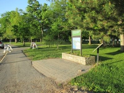
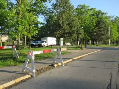
Location. 43° 4.842′ N, 79° 4.298′ W. Marker is in Niagara Falls, New York, in Niagara County. Marker is on Goat Island Road, on the right when traveling south. Marker is at the midpoint of the west edge of the Goat Island parking lot in Niagara Falls State Park. It is next to a service driveway for the building housing the Top of the Falls Restaurant. Touch for map. Marker is in this post office area: Niagara Falls NY 14303, United States of America. Touch for directions.
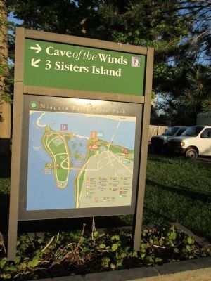
Other nearby markers. At least 8 other markers are within walking distance of this marker. Lafayette's Tour (about 400 feet away, measured in a direct line); The Power Portal (about 400 feet away); World's First Hydroelectric Power Plant (about 400 feet away); Nik Wallenda & Niagara (about 500 feet away); Original Stepping Stone (about 500 feet away); Cave of the Winds Elevator (about 600 feet away); Cave of the Winds and Bridal Veil Falls (about 800 feet away); The Cave of the Winds (about 800 feet away). Touch for a list and map of all markers in Niagara Falls.
More about this marker. Expect to pay for parking on Goat Island.
Regarding Goat Island. Niagara Reservation State Park is now called Niagara Falls State Park.
Also see . . . Niagara Falls State Park. NYS Parks, Recreation and Historic Preservation website entry (Submitted on June 3, 2014, by Anton Schwarzmueller of Wilson, New York.)
Credits. This page was last revised on January 5, 2022. It was originally submitted on June 3, 2014, by Anton Schwarzmueller of Wilson, New York. This page has been viewed 680 times since then and 29 times this year. Photos: 1, 2, 3, 4. submitted on June 3, 2014, by Anton Schwarzmueller of Wilson, New York. • Bill Pfingsten was the editor who published this page.


