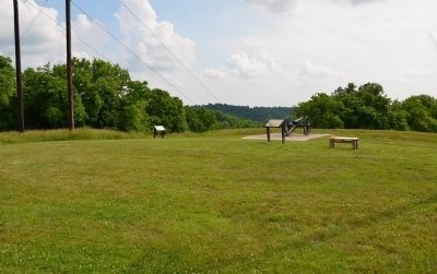
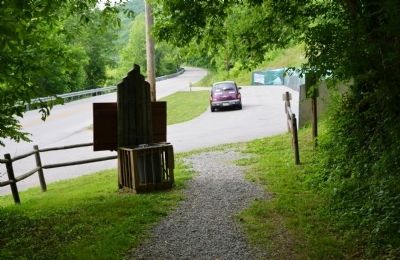
Near Winchester in Clark County, Kentucky — The American South (East South Central)
Inside the Earthwork
An Unanswered Question
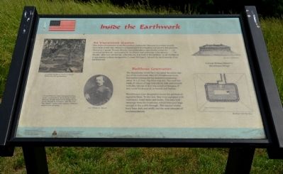
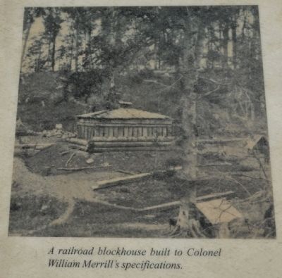
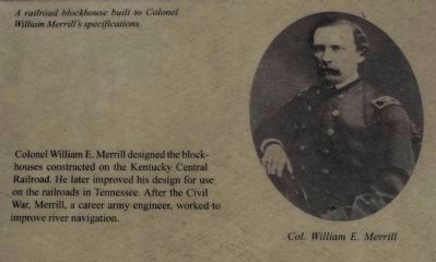
Was there a blockhouse at the Boonesboro earthwork? Because no written records have been found only intensive archaeological investigation can answer that question. However, Captain Thomas Brooks' recommendation specifically called for "...an enclosed earthwork, surrounded by an abattis and enclosing a blockhouse...." If Brooks' plan was carried out, a blockhouse was built at Boonesboro. In all likelihood it was similar to those designed by Colonel William E. Merrill for the Kentucky Central Railroad.
Blockhouse Construction
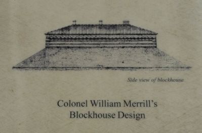
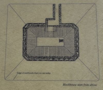
The blockhouse would have occupied the entire interior of the earthwork. Merrill's blockhouses were flat-roofed rectangular log structures measuring about 18 x 25 feet. The floor was dirt. The roof was made of a layer of logs laid side by side and covered with dirt. On top of that was a roof of shingles, if they could be procured, or boards and battens.
Blockhouses were designed to house the garrison assigned to them. To this end, they were equipped with ventilators, water tanks and bunks. The only wall openings were the loopholes, which were just large enough to fire a rifle through. The interior would have been dark and stuffy, not the most pleasant of accommodations.
Erected by The Winchester/Clark County Tourism Commission.
Topics. This historical marker is listed in this topic list: War, US Civil.
Location. 37° 53.352′ N, 84° 15.512′ W. Marker is near Winchester, Kentucky, in Clark County. Marker can be reached from Ford Road (Kentucky Route 1924) 1.2 miles south of Boonesboro Road (Kentucky Route 627), on the left when traveling south. The exhibit can be reached from the trailhead parking area on KY Route 1924. It is a ½ mile hike up the trail to the top of the hill where the fort is. Touch for map. Marker is at or near this postal address: 1250 Ford Road, Winchester KY 40391, United States of America. Touch for directions.
Other nearby markers. At least 8 other markers are within walking distance of this marker. Building the Earthwork (a few steps from this marker); Thomas B. Brooks, Army Engineer (about 300 feet away, measured in a direct line); A Defensive Strategy (about 300 feet away); An Unrealized Plan (about 300 feet away); Common Cliffside Plants (about 400 feet away); Rock and Man (about 500 feet away); The Eye of the Rich Land (about 500 feet away); The Quest for Land (about 500 feet away). Touch for a list and map of all markers in Winchester.
More about this marker. CAUTION: The climb up the hill is VERY steep. It involves a change in elevation of 230 feet. Not recommended for people that are not in good physical
shape or condition.
Also see . . . Civil War Fort at Boonesboro. (Submitted on June 19, 2014.)
Photographed By Karl Stelly, June 1, 2014
4. Col. William E. Merrill
Colonel William E. Merrill designed the blockhouses constructed on the Kentucky Central Railroad. He later improved his design for use on the railroads in Tennessee. After the Civil War, Merrill, a career army engineer, worked to improve river navigation.
Credits. This page was last revised on June 16, 2016. It was originally submitted on June 17, 2014, by Karl Stelly of Gettysburg, Pennsylvania. This page has been viewed 556 times since then and 15 times this year. Photos: 1, 2, 3, 4, 5, 6, 7. submitted on June 17, 2014, by Karl Stelly of Gettysburg, Pennsylvania. • Bernard Fisher was the editor who published this page.
