North in Mathews County, Virginia — The American South (Mid-Atlantic)
Mathews County
Historic Sites
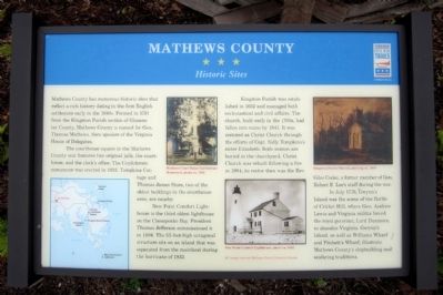
Mathews County has numerous historic sites that reflect a rich history dating to the first English settlement early in the 1640s. Formed in 1791 from the Kingston Parish section of Gloucester County, Mathews County is named for Gen. Thomas Mathews, then speaker of the Virginia House of Delegates.
The courthouse square in the Mathews County seat features two original jails, the court house, and the clerk’s office. The Confederate monument was erected in 1912. Tompkins Cottage and Thomas James Store, two of the oldest buildings in the courthouse area, are nearby.
New Point Comfort Lighthouse is the third oldest lighthouse on the Chesapeake Bay. President Thomas Jefferson commissioned it in 1804. The 55-foot-high octagonal structure sits on an island that was separated from the mainland during the hurricane of 1933.
Kingston Parish was established in 1652 and managed both ecclesiastical and civil affairs. The church, built early in the 1700s, had fallen into ruins by 1841. It was restored as Christ Church through the efforts of Capt. Sally Tompkins’s sister Elizabeth. Both women are buried in the churchyard. Christ Church was rebuilt following a fire in 1904; its rector then was the Rev. Giles Cooke, a former member of Gen. Robert E. Lee’s staff during the war.
In July 1776, Gwynn’s Island was the scene of the Battle of Cricket Hill, where Gen. Andrew Lewis and Virginia militia forced the royal governor, Lord Dunmore, to abandon Virginia. Gwynn’s Island, as well as Williams Wharf and Fitchett's Wharf, illustrate Mathews County's shipbuilding and seafaring traditions.
(captions)
(upper left) Mathews Court House Confederate Monument, photo ca. 1912
(lower right) New Point Comfort Lighthouse, photo ca. 1885
(upper right) Kingston Parish Church, painting ca. 1850
All images courtesy Mathews County Historical Society
Erected 2014 by Virginia Civil WarTrails.
Topics and series. This historical marker is listed in these topic lists: Churches & Religion • Colonial Era • War, US Civil • War, US Revolutionary. In addition, it is included in the Lighthouses, and the Virginia Civil War Trails series lists. A significant historical year for this entry is 1640.
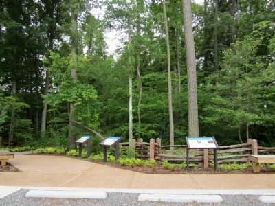
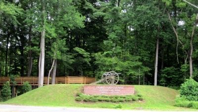
Location. 37° 28.016′ N, 76° 26.685′ W. Marker is in North, Virginia, in Mathews County. Marker can be reached from Windsor Road (Virginia Route 3) 0.2 miles north of John Clayton Memorial Highway (Virginia Route 14), on the right when traveling north. Located near the parking lot of Fort Nonsense Historical Park. Touch for map. Marker is in this post office area: North VA 23128, United States of America. Touch for directions.
Other nearby markers. At least 8 other markers are within walking distance of this marker. Fort Nonsense (a few steps from this marker); By Land And By Sea (a few steps from this marker); Field Fortifications (within shouting distance of this marker); a different marker also named Fort Nonsense (within shouting distance of this marker); Civil War In Mathews County (about 400 feet away, measured in a direct line); John Clayton, Botanist (about 400 feet away); a different marker also named Civil War In Mathews County (about 400 feet away); a different marker also named Civil War In Mathews County (about 500 feet away). Touch for a list and map of all markers in North.
Credits. This page was last revised on June 27, 2021. It was originally submitted on June 22, 2014, by Bernard Fisher of Richmond, Virginia. This page has been viewed 486 times since then and 14 times this year. Photos: 1, 2, 3, 4. submitted on June 22, 2014, by Bernard Fisher of Richmond, Virginia.


