North in Mathews County, Virginia — The American South (Mid-Atlantic)
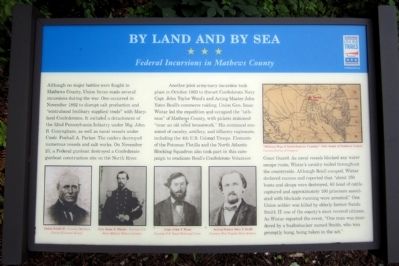
By Land And By Sea
Federal Incursions in Mathews County
Another joint army-navy incursion took place in October 1863 to thwart Confederate Navy Capt. John Taylor Wood's and Acting Master John Yates Beall's commerce raiding. Union Gen. Isaac Wistar led the expedition and occupied the “isthmus” of Mathews County, with pickets stationed “near an old rebel breastwork.” His command consisted of cavalry, artillery, and infantry regiments, including the 4th U.S. Colored Troops. Elements of the Potomac Flotilla and the North Atlantic Blocking Squadron also took part in this campaign to eradicate Beall's Confederate Volunteer Coast Guard. As naval vessels blocked any water escape route, Wistar's cavalry raided throughout the countryside. Although Beall escaped, Wistar declared success and reported that “about 150 boats and sloops were destroyed, 80 head of cattle captured and approximately 100 prisoners associated with blockade running were arrested.“ One Union soldier was killed by elderly farmer Sands Smith II, one of the county's most revered citizens. As Wistar reported the event, “One man was murdered by a bushwhacker named Smith, who was promptly hung, being taken in the act.”
(captions)
(lower left) Sands Smith II - Courtesy Mathews County Historical Society; Gen. Isaac J. Wister - Courtesy U.S. Army Military History Institute; Capt. John T. Wood Courtesy U.S. Naval Historical Center; Acting Master John Y. Beall Courtesy West Virginia Satte Archives
(upper right) "Military Map of South-Eastern Virginia," 1865, detail of Mathews County Courtesy Library of Congress
Erected 2014 by Virginia Civil WarTrails.
Topics and series. This historical marker is listed in these topic lists: War, US Civil • Waterways & Vessels. In addition, it is included in the Virginia Civil War Trails series list. A significant historical month for this entry is October 1863.
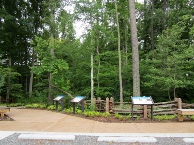
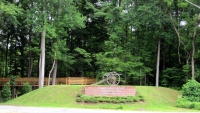
Location. 37° 28.015′ N, 76° 26.676′ W. Marker is in North, Virginia, in Mathews County. Marker can be reached from Windsor Road (Virginia Route 3) 0.2 miles north of John Clayton Memorial Highway (Virginia Route 14), on the right when traveling north. Located near the parking lot of Fort Nonsense Historical Park. Touch for map. Marker is in this post office area: North VA 23128, United States of America. Touch for directions.
Other nearby markers. At least 8 other markers are within walking distance of this marker. Fort Nonsense (here, next to this marker); Mathews County (a few steps from this marker); Field Fortifications (within shouting distance of this marker); a different marker also named Fort Nonsense (within shouting distance of this marker); Civil War In Mathews County (about 400 feet away, measured in a direct line); John Clayton, Botanist (about 400 feet away); a different marker also named Civil War In Mathews County (about 400 feet away); a different marker also named Civil War In Mathews County (about 500 feet away). Touch for a list and map of all markers in North.
Credits. This page was last revised on June 16, 2016. It was originally submitted on June 22, 2014, by Bernard Fisher of Richmond, Virginia. This page has been viewed 532 times since then and 21 times this year. Photos: 1, 2, 3, 4. submitted on June 22, 2014, by Bernard Fisher of Richmond, Virginia.


