Near Hartfield in Middlesex County, Virginia — The American South (Mid-Atlantic)
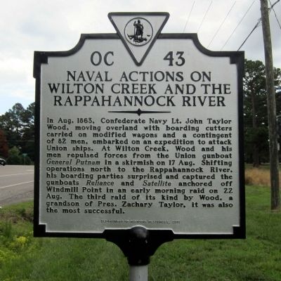
Naval Actions on Wilton Creek and the Rappahannock River
Inscription.
In Aug. 1863, Confederate Navy Lt. John Taylor Wood, moving overland with boarding cutters carried on modified wagons and a contingent of 82 men, embarked on an expedition to attack Union ships. At Wilton Creek, Wood and his men repulsed forces from the Union gunboat General Putnam in a skirmish on 17 Aug. Shifting operations north to the Rappahannock River, his boarding parties surprised and captured Union gunboats, Reliance and Satellite, anchored off Windmill Point in an early morning raid on 22 Aug. The third raid of its kind by Wood, a grandson of Pres. Zachary Taylor, it was also the most successful.
Erected 2011 by Department of Historic Resources. (Marker Number OC-43.)
Topics and series. This historical marker is listed in these topic lists: War, US Civil • Waterways & Vessels. In addition, it is included in the Former U.S. Presidents: #12 Zachary Taylor, and the Virginia Department of Historic Resources (DHR) series lists. A significant historical month for this entry is August 1863.
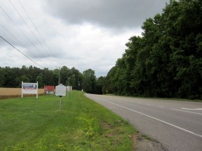
Location. 37° 32.943′ N, 76° 24.435′ W. Marker is near Hartfield, Virginia, in Middlesex County. Marker is at the intersection of General Puller Highway (Virginia Route 33) and Woodport Lane, on the right when traveling east on General Puller Highway. Touch for map. Marker is in this post office area: Hartfield VA 23071, United States of America. Touch for directions.
Other nearby markers. At least 8 other markers are within 5 miles of this marker, measured as the crow flies. Stingray Point (approx. 2.1 miles away); Lower Methodist Church (approx. 2.9 miles away); Stingray Point Contraband (approx. 3.7 miles away); a different marker also named Stingray Point (approx. 3.7 miles away); Gloucester County / Mathews County (approx. 4.2 miles away); Dr. Copter — Flying Medicine to Tangier (approx. 4.3 miles away); F.D. Crockett (approx. 4.4 miles away); Captain John Smith’s Shallop (approx. 4˝ miles away). Touch for a list and map of all markers in Hartfield.
Credits. This page was last revised on June 16, 2016. It was originally submitted on June 22, 2014, by Bernard Fisher of Richmond, Virginia. This page has been viewed 536 times since then and 16 times this year. Photos: 1, 2. submitted on June 22, 2014, by Bernard Fisher of Richmond, Virginia.

