Millers Tavern in Essex County, Virginia — The American South (Mid-Atlantic)
King and Queen County
⎯⎯⎯
Essex County
Photographed by Beverly Pfingsten, April 18, 2008
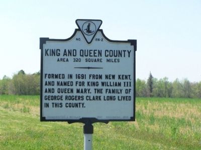
1. King and Queen County Marker (obverse)
King and Queen County. Area 320 Square Miles. Formed in 1691 from New Kent, and named for King William III and Queen Mary. The family of George Rogers Clark long lived in this county.
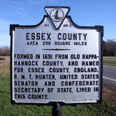
Essex County. Area 258 Square Miles. Formed in 1691 from Old Rappahannock County, and named for Essex County, England. R. M. T. Hunter, United States Senator and Confederate Secretary of State, lived in this county.
Erected 1929 by Conservation Development Commission. (Marker Number Z-166.)
Topics and series. This historical marker is listed in these topic lists: Colonial Era • Political Subdivisions • Settlements & Settlers • War, US Civil. In addition, it is included in the Virginia Department of Historic Resources (DHR) series list. A significant historical year for this entry is 1691.
Location. 37° 49.753′ N, 76° 57.024′ W. Marker is in Millers Tavern, Virginia, in Essex County. It is on US 360, on the right when traveling west. Marker is at county line. Touch for map. Marker is in this post office area: Millers Tavern VA 23115, United States of America. Touch for directions.

Regionally, this marker is on the Middle
this page online
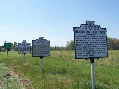
Other nearby markers. At least 8 other markers are within 7 miles of this marker, measured as the crow flies: Mattaponi Indian Town (here, next to this marker); Bacon's Northern Force (a few steps from this marker); Mt. Zion Baptist Church (approx. ¼ mile away); Bruington Church (approx. 4.2 miles away); Hillsboro (approx. 5½ miles away); Apple Tree Church (approx. 5.6 miles away); Clark Home (approx. 5.7 miles away); State Fish Hatchery (approx. 6.7 miles away). Touch for a list and map of all markers in Millers Tavern.
Another marker is no longer nearby. Mount Pleasant (was approx. one mile away but has been confirmed missing).
Also see . . .
1. King and Queen County, Virginia.
Photographed by Bernard Fisher, December 6, 2009
2. Essex County Marker (reverse)
2. Essex County, Virginia and the town of Tappahannock. (Submitted on March 30, 2010, by Bernard Fisher of Richmond, Virginia.)
Photographed by Beverly Pfingsten, April 18, 2008
3. Three markers grouped together
Bacon's Northern Force
Mattaponi Indian Town
King and Queen County
Mattaponi Indian Town
King and Queen County
Credits. This page was last revised on July 6, 2021. It was originally submitted on April 30, 2008, by Bill Pfingsten of Bel Air, Maryland. This page has been viewed 1,996 times since then and 44 times this year. Photos: 1. submitted on April 30, 2008, by Bill Pfingsten of Bel Air, Maryland. 2. submitted on December 8, 2009, by Bernard Fisher of Richmond, Virginia. 3. submitted on April 30, 2008, by Bill Pfingsten of Bel Air, Maryland.
