Marker Logo HMdb.org THE HISTORICAL
MARKER DATABASE
“Bite-Size Bits of Local, National, and Global History”
Near Wapakoneta in Auglaize County, Ohio — The American Midwest (Great Lakes)
 

Wapaghonetta Reservation

the Shawnee Reservation at Wapakoneta

— the Eastern Boundary marker —


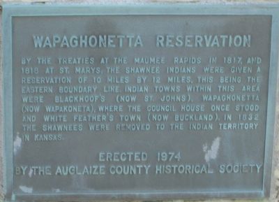
Wapaghonetta Reservation Marker close up image. Click for full size.
Photographed By Rev. Ronald Irick, November 16, 2012
1. Wapaghonetta Reservation Marker close up
Inscription. By the Treaties at the Maumee Rapids in 1817, and 1818 at St. Mary’s, the Shawnee Indians were given a reservation of ten miles by twelve miles. This being the eastern boundary line. Indian Towns within this area were Blackhoof’s (now St. Johns), Wapaghonetta (now Wapakoneta), where the Council House once stood and White Feather’s Town (now Buckland). In 1832 the Shawnee were removed to the Indian Territory in Kansas.
 
Erected 1974 by Auglaize County Historical Society.
 
Topics. This historical marker is listed in this topic list: Native Americans. A significant historical year for this entry is 1817.
 
Location. 40° 33.392′ N, 84° 2.692′ W. Marker is near Wapakoneta, Ohio, in Auglaize County. Marker is at the intersection of Ohio Route 65 and U.S. 33, on the right when traveling north on State Route 65. Marker is in a grassy area at the SE corner of St Rt 65 and US 33, about two miles East of the village of St. Johns, Ohio. Touch for map. Marker is at or near this postal address: 21198 Ohio 65, Wapakoneta OH 45895, United States of America. Touch for directions.
 
Other nearby markers. At least 8 other markers are within 5 miles of this marker, measured as the crow flies. Catahecassa (approx. 2 miles away); Blackhoof's Last Home (approx. 2.1 miles away); First On The Moon (approx. 3.7 miles away); Uniopolis Veteran's Park
Paid Advertisement
Click on the ad for more information.
Please report objectionable advertising to the Editor.
Click or scan to see
this page online
(approx. 3.8 miles away); Uniopolis Veterans Memorial (approx. 3.8 miles away); Uniopolis Town Hall (approx. 3.8 miles away); Waynesfield Veterans Memorial (approx. 4.6 miles away); Waynesfield United Methodist Church Veterans Memorial (approx. 4.8 miles away).
 
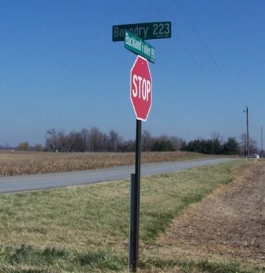
More about this marker. St Rt 65 turns West with US 33 at this point, but the Northbound extension as a county road is "Boundary Road" in Auglaize County. As it reaches Allen County it forms the NE corner of the Reservation. Southbound St Rt 65 is the Eastern Boundary for 3 1/3 miles,(a slight jog in the road denotes the SE corner of the Reservation.)
 
Regarding Wapaghonetta Reservation. The reservation was formed by the Treaty at the Foot of the Maumee Rapids, in 1817. It was dissolved by the Treaty of St. Mary's, in 1832
 
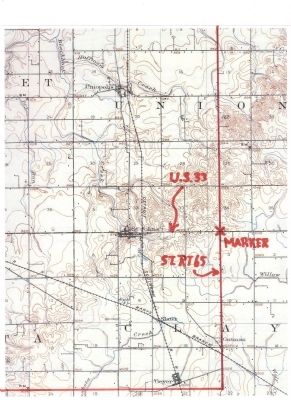
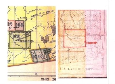
Wapaghonetta Reservation Map image. Click for full size.
Photographed By Rev. Ronald Irick, July 8, 2014
2. Wapaghonetta Reservation Map
part of Royce Land Cession map,with Piqua Land District map, edited, marked and colored by Dr. Ronald Irick, comparing lay out of Wapaghonetta Reservation, and showing location of subject marker.
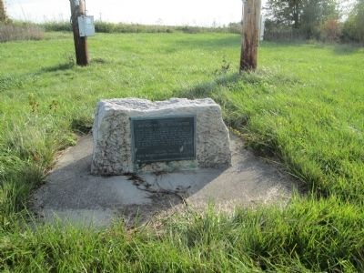
Wapaghonetta Reservation Marker image. Click for full size.
Photographed By Rev. Ronald Irick, November 16, 2012
3. Wapaghonetta Reservation Marker
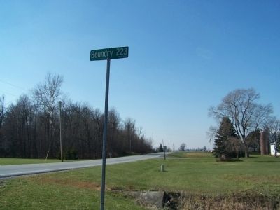
Boundary Road sign image. Click for full size.
Photographed By Rev. Ronald Irick, November 21, 2013
4. Boundary Road sign
Boundary Road is the Eastern border of the Reservation
Wapaghonetta Reservation Marker image. Click for full size.
Photographed By Rev. Ronald Irick, November 21, 2013
5. Wapaghonetta Reservation Marker
at StRt 67, the road from Upper Sandusky to Wapakoneta, across the Scioto Marsh, and the “Glaize”
Wapaghonetta Reservation topo map image. Click for full size.
Photographed By Rev. Ronald Irick, July 8, 2014
6. Wapaghonetta Reservation topo map
USGS 1906 Lima se topo map, edited, marked, and colored by Dr. Ronald Irick, showing Eastern and Southern Boundary of the reservation, and location of the marker.
 
 
Credits. This page was last revised on December 28, 2023. It was originally submitted on July 8, 2014, by Rev. Ronald Irick of West Liberty, Ohio. This page has been viewed 1,559 times since then and 319 times this year. Last updated on December 3, 2023, by Craig Doda of Napoleon, Ohio. Photos:   1, 2, 3, 4, 5, 6. submitted on July 8, 2014, by Rev. Ronald Irick of West Liberty, Ohio. • J. Makali Bruton was the editor who published this page.
Share this page.  
Share on Tumblr
m=237213

CeraNet Cloud Computing sponsors the Historical Marker Database.
This website earns income from purchases you make after using our links to Amazon.com. We appreciate your support.
Paid Advertisement
Apr. 24, 2024