Asheville in Buncombe County, North Carolina — The American South (South Atlantic)
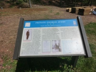
Private George Avery
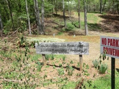
South Asheville Colored Cemetery
Avery’s regiment guarded railroads in Tennessee for the rest of the war. Although Avery had enlisted for three years, he and the regiment were mustered out on April 25, 1866. Avery returned to Asheville, where the McDowells provided him with land, lumber to construct a house, and a job as the cemetery’s caretaker that he kept until his death at the age of 96. His tombstone (three stones, midway up the hill) proudly acknowledges his Union service.
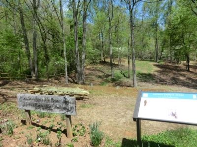
This is the oldest African American public cemetery in western North Carolina. The McDowell family established a slave cemetery here in the mid-1800s. After the war, caretaker George Avery received $1 for digging each grave, and McDowell’s widow received $1 for the plot if the family could afford it. After her death in 1905, St. John “A” Baptist and St. Mark A.M.E. Churches took over maintenance.
The cemetery had no written plan or map. Avery tracked grave locations by memory. The earliest graves were marked with wooden planks that are long gone. Boulders or rough-shaped stones mark many graves. The cemetery closed in 1943. Today, South Asheville Cemetery Association volunteers maintain this site. Archaeologists have documented 1,921 graves.
Sarah Gudger lived on this street when interviewed for the WPA Slave Narrative Project in May 1937. She is buried here. “When the war come…the darkies didn’t know what it was all about. …One day I never forget, we look about and see soldiers marching; look like the whole valley full of them. I thought, 'Poor helpless crafters, just going away to get killed.' The drums were beating and the fifes a playing. …Oh, glory, it was a sight.”
(captions)
(upper left) George Avery, Feb. 18, 1917, age 71 Smith-McDowell House Museum
(lower center) George Avery’s enlistment paper Smith-McDowell House Museum
(lower right) Sarah Gudger Courtesy Library of Congress
Erected by North Carolina Civil War Trails.
Topics and series. This historical marker is listed in these topic lists: African Americans • Cemeteries & Burial Sites • War, US Civil. In addition, it is included in the African Methodist Episcopal (AME) Church, and the North Carolina Civil War Trails series lists. A significant historical month for this entry is April 1865.
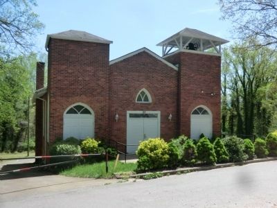
Location. 35° 34.879′ N, 82° 32.28′ W. Marker is in Asheville, North Carolina, in Buncombe County. Marker can be reached from Dalton Street, 0.3 miles north of Wyoming Road, on the right when traveling north. The marker is in the cemetery located in the rear of St. John "A" Baptist Church. Touch for map. Marker is at or near this postal address: 20 Dalton Street, Asheville NC 28803, United States of America. Touch for directions.
Other nearby markers. At least 8 other markers are within one mile of this marker, measured as the crow flies. Newton Academy (approx. 0.6 miles away); Asheville Normal School (approx. ¾ mile away); St. Genevieve ~ Of ~ The ~ Pines (approx. 0.9 miles away); Flood of 1916 (approx. 0.9 miles away); Lee's School (approx. one mile away); The County of Buncombe (approx. one mile away); Isaac Dickson and the Historical East End Neighborhood (approx. one mile away); Asheville's Enslaved People (approx. one mile away). Touch for a list and map of all markers in Asheville.
Related marker. Click here for another marker that is related to this marker.
Credits. This page was last revised on August 5, 2019. It was originally submitted on July 20, 2014, by Don Morfe of Baltimore, Maryland. This page has been viewed 1,000 times since then and 26 times this year. Photos: 1, 2, 3, 4. submitted on July 20, 2014, by Don Morfe of Baltimore, Maryland. • Bernard Fisher was the editor who published this page.


