South End in Burlington in Chittenden County, Vermont — The American Northeast (New England)
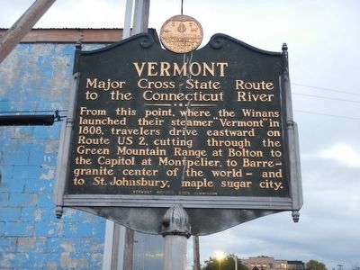
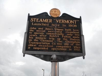
Vermont / Steamer "Vermont"
Inscription.
Major Cross-State Route to the Connecticut River
From this point, where the Winans launched their steamer "Vermont" in 1808, travelers drive eastward on Route US 2, cutting through the Green Mountain Range at Bolton to the Capitol at Montpelier, to Barre - granite center of the world - and to St. Johnsbury, maple sugar city.
Launched here in 1808
John and James Winans built here the second successful steamboat to operate commercially, only two years after Robert Fulton made his historic trip up the Hudson on the "Clermont". The Champlain Transportation Co. was one of the oldest steamboat companies when it suspended operation in 1932.
Erected 1949 by Vermont Historic Sites Commission.
Topics. This historical marker is listed in these topic lists: Roads & Vehicles • Waterways & Vessels. A significant historical year for this entry is 1808.
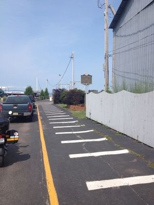
Location. 44° 28.47′ N, 73° 13.251′ W. Marker is in Burlington, Vermont, in Chittenden County. It is in South End. Marker is on King Street Dock, 0.1 miles west of Battery Street, on the right when traveling west. The marker is located next to the loading lanes for the Burlington (VT) - Port Kent (NY) ferry. Touch for map. Marker is in this post office area: Burlington VT 05401, United States of America. Touch for directions.
Other nearby markers. At least 8 other markers are within walking distance of this marker. Ground Beneath Your Feet (about 400 feet away, measured in a direct line); Dr. Charles N. Perkins (about 400 feet away); Lake Champlain Navy Memorial (about 500 feet away); Union Station (about 600 feet away); The Battle of Plattsburgh Bay (about 600 feet away); The Lone Sailor (about 600 feet away); The Battle of Valcour Island (about 600 feet away); George Dewey, Admiral of the Navy, U.S.N. (about 600 feet away). Touch for a list and map of all markers in Burlington.
Also see . . . Wikipedia - U.S. Route 2 in Vermont. (Submitted on September 14, 2015, by Kevin Craft of Bedford, Quebec.)
Credits. This page was last revised on February 16, 2023. It was originally submitted on July 22, 2014, by Kevin Craft of Bedford, Quebec. This page has been viewed 564 times since then and 31 times this year. Photos: 1, 2. submitted on September 14, 2015, by Kevin Craft of Bedford, Quebec. 3. submitted on July 22, 2014, by Kevin Craft of Bedford, Quebec. • Bill Pfingsten was the editor who published this page.


