Ogdensburg in St. Lawrence County, New York — The American Northeast (Mid-Atlantic)
Aka Se We':Ka Tsi (Oswegatchie)
Cultural & Economic Crossroads
| — | Iroquois Settlement 1749-1759 | — |
Photographed by William Fischer, Jr., July 4, 2014
1. Aka Se We':Ka Tsi (Oswegatchie) Marker
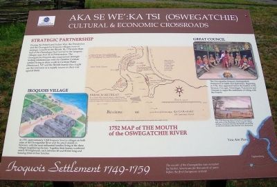
Iroquois Village
In 1751, approximately 3,000 Iroquois lived in villages on both sides of the Oswegatchie River and the small islands in between, with the most influential families living in the three villages neighboring the fort. Together their homes numbered nearly 50 longhouses, each between 60 and 80 feet long and housing three or four families.
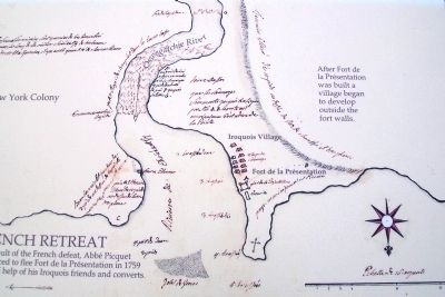
1752 Map of The Mouth of the Oswegatchie River
Map derived from a French drawing, distortions resulted from the incomplete data available at the time.
After Fort de la Présentation was built a village began to develop outside the fort walls.
As a result of the French defeat, Abbé Picquet was forced to flee Fort de la Présentation in 1759 with the help of his Iroquois friends and converts.
Strategic Partnership
During the French and Indian War, the French fort and the Oswegatchie Iroquois villages were of strategic concern to the British. By 1754 more than half of the Onondagas had moved to the Iroquois villages near Fort de la Présentation. The Oswegatchie Iroquois also maintained strategic trading relationships with the Palatine German settlers living to the south
this page online
The Oswegatchie Iroquois distinguished themselves in battle and diplomacy. Beginning in 1756, they appeared before the leaders of the Senecas, Cayugas, Onondagas, Tuscaroras and Oneidas to argue the usefulness of siding with the French.
This 1760 drawing shows Fort de la Présentation and some of the buildings of the Iroquois village during a skirmish between the British and French on the river shortly after the fort was abandoned.
Erected by Fort de la Présentation Association.
Topics and series. This historical marker is listed in these topic lists: Forts and Castles • Indigenous Peoples and Communities • Patriots & Patriotism • War, French and Indian. In addition, it is included in the Great Lakes Seaway Trail National Scenic Byway series list. A significant historical year for this entry is 1751.
Location. 44° 41.667′ N, 75° 30.073′ W. Marker is in Ogdensburg, New York, in St. Lawrence County. It is on the Downtown Arterial (New York State Route 68) west of Commerce Street, on the right
Photographed by Unknown French Mapmaker, circa late 1700s
2. Map on Aka Se We':Ka Tsi (Oswegatchie) Marker

Regionally, this marker is in Upstate New York and in the Adirondacks & North Country. It is also in the American Northeast and in the Mid-Atlantic. Globally, it is in North America, the Western Hemisphere, the Western World, and the Anglosphere. Historically, it finds itself in what was once the Viceroyalty of New France, the Haudenosaunee (Iroquois) Confederacy, New Netherland, and one of the original Thirteen Colonies.
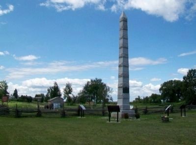
Other nearby markers. At least 8 other markers are within walking distance of this marker: Fort la Présentation (here, next to this marker); Fort de la Présentation - 1749-1759 (here, next to this marker); Fort Lévis - 1760 (here, next to this marker); Fort Oswegatchie 1760-1796 (here, next to this marker); The Battle of Ogdensburg (here, next to this marker); Fort de la Présentation (here, next to this marker); 300 Years of Artifacts, Refuse and Pollution (about 300 feet away, measured in a direct line); An Outdoor Geology Museum (about 400 feet away). Touch for a list and map
Photographed by William Fischer, Jr.
3. Fort la Présentation Obelisk and Related Markers
Also see . . .
1. Iroquois History. Warrior Society entry (Submitted on August 3, 2014, by William Fischer, Jr. of Reynoldsburg, Ohio.)
2. Ogdensburg NY. Advisory Council on Historic Preservation entry (Submitted on August 3, 2014, by William Fischer, Jr. of Reynoldsburg, Ohio.)
via The Canadian Encyclopedia
4. Seven Nations
The Canadian Encyclopedia website entry:
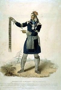
Nicholas Isawanhanhi, Huron chief, shown wearing the regimental coat commonly awarded to Indigenous trading captains during the fur trade.
(Library and Archives Canada/C-38948)
Click for more information.
Nicholas Isawanhanhi, Huron chief, shown wearing the regimental coat commonly awarded to Indigenous trading captains during the fur trade.
(Library and Archives Canada/C-38948)
Click for more information.
Credits. This page was last revised on June 14, 2025. It was originally submitted on August 2, 2014, by William Fischer, Jr. of Reynoldsburg, Ohio. This page has been viewed 1,113 times since then and 51 times this year. Photos: 1, 2. submitted on August 3, 2014, by William Fischer, Jr. of Reynoldsburg, Ohio. 3. submitted on July 28, 2014, by William Fischer, Jr. of Reynoldsburg, Ohio. 4. submitted on May 22, 2021, by Larry Gertner of New York, New York.
