Near Painter in Accomack County, Virginia — The American South (Mid-Atlantic)
Accomack County / Northampton County
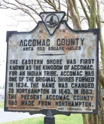
Accomack County. Area 502 Square Miles. The Eastern Shore was first known as the Kingdom of Accomack, for an Indian tribe. Accomac was one of the original shires formed in 1634. The name was changed to Northampton in 1643. In 1663, the present Accomac County was made from Northampton.
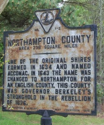
Northampton County. Area 239 Square Miles. One of the original shires formed in 1634 and named Accomack. In 1643 the name was changed to Northampton for an English County. This county was Governor Berkeley's stronghold in the rebellion of 1676.
Erected 1928 by Conservation Development Commission. (Marker Number Z-1.)
Topics and series. This historical marker is listed in these topic lists: Colonial Era • Native Americans • Settlements & Settlers. In addition, it is included in the Virginia Department of Historic Resources (DHR) series list. A significant historical year for this entry is 1634.
Location. 37° 32.571′ N, 75° 48.813′ W. Marker is near Painter, Virginia, in Accomack County. Marker is at the intersection of County Line Road and County Line Road, on the right when traveling north on County Line Road. Touch for map. Marker is at or near this postal address: 15525 County Line Road, Belle Haven VA 23306, United States of America. Touch for directions.
Other nearby markers. At least 8 other markers are within 7 miles of this marker, measured as the crow flies. Occahannock (here, next to this marker); Occohannock Indians (approx. 0.7 miles away); Site of Willis Store-House (approx. ¾ mile away); The Old Willis Wharf Storehouse (approx. 1.9 miles away); Peter Jacob Carter (approx. 6 miles away); St. George's Episcopal Church (approx. 6.3 miles away); “The Bear and the Cub” (approx. 6.4 miles away); a different marker also named “The Bear and the Cub” (approx. 6½ miles away).
Credits. This page was last revised on July 8, 2021. It was originally submitted on May 4, 2008, by Bill Pfingsten of Bel Air, Maryland. This page has been viewed 1,774 times since then and 60 times this year. Photos: 1, 2. submitted on May 4, 2008, by Bill Pfingsten of Bel Air, Maryland.
Editor’s want-list for this marker. A wide shot of the marker in context. • Can you help?

