Near Nekoosa in Wood County, Wisconsin — The American Midwest (Great Lakes)
Point Basse
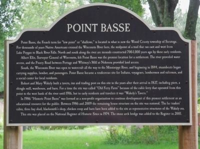
Point Basse, the French term for "low point" or "shallows," is located in what is now the Wood County township of Saratoga. For thousands of years Native Americans crossed the Wisconsin River here, the midpoint of a trail that ran east and west from Lake Poygan to Black River Falls. North and south along the river are mounds constructed 700-1,000 years ago by these early residents.
Albert Ellis, Surveyor General of Wisconsin, felt Point Basse was the premier location for a settlement. The river provided water access, and the Pinery Road between Portage and Whitney's Mill at Nekoosa provided land access.
South, the Wisconsin River was open to watercraft all the way to the Mississippi River, and beginning in 1844, steamboats began carrying supplies, lumber, and passengers. Point Basse became a rendezvous site for Indians, voyageurs, lumbermen and raftsmen, and a social center for local residents.
Robert and Mary Wakely built a tavern, inn and trading post on this site in the years after their arrival in 1837, including piers, a shingle mill, warehouse, and barn. For a time the site was called "Old Ferry Farm" because of the cable ferry that operated from this point to the west bank of the river until 1916, but to early residents and travelers it was "Wakely's Tavern."
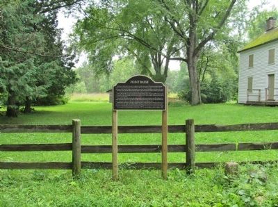
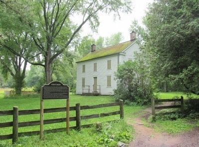
In 1986 "Historic Point Basse" was formed as a non-profit organization to continue development of this pioneer settlement as an educational resource for the public. Between 1986 and 2009 the remaining house structure on the site was restored. The fur traders' cabin, three bay shed, blacksmith's shop, chicken coop and barn have been added to the site as representative structures of the Wakely era.
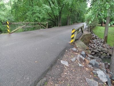
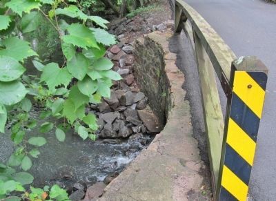
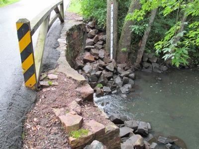
The site was placed on the National Register of Historic Sites in 1974. The stone arch bridge was added to the Register in 2001.
Topics. This historical marker is listed in these topic lists: Industry & Commerce • Native Americans • Settlements & Settlers • Waterways & Vessels. A significant historical year for this entry is 1844.
Location. 44° 17.997′ N, 89° 53.436′ W. Marker is near Nekoosa, Wisconsin, in Wood County. Marker is on Wakely Road, 0.3 miles west of County Highway Z, on the left when traveling west. Touch for map. Marker is in this post office area: Nekoosa WI 54457, United States of America. Touch for directions.
Other nearby markers. At least 8 other markers are within 4 miles of this marker, measured as the crow flies. Point Bas (approx. 0.2 miles away); Nekoosa War Memorial (approx. 1.2 miles away); a different marker also named Point Basse (approx. 1.6 miles away); Ed “Strangler” Lewis (approx. 1.7 miles away); Veterans Memorial (approx. 1.7 miles away); John Edwards Jr. (approx. 3.2 miles away); John Jones 2nd Burial Site (approx. 3.9 miles away); John Edwards Jr. Office Building (approx. 4 miles away). Touch for a list and map of all markers in Nekoosa.
Also see . . .
1. Wisconsin Historical Society. Architecture and History Inventory. Wakely's Tavern. (Submitted on August 18, 2014.)
2. Wisconsin Historical Society. National Register. Wakely's Tavern. (Submitted on August 18, 2014.)
3. Wisconsin Historical Society. Architecture and History Inventory. Wakely Road Bridge. (Submitted on August 18, 2014, by Keith L of Wisconsin Rapids, Wisconsin.)
4. Wisconsin Historical Society. National Register. Wakely Road spanning Wakely Creek. (Submitted on August 18, 2014.)
Additional keywords. Wisconsin Heritage Site #209 · Point Basse Bridge
Credits. This page was last revised on August 5, 2021. It was originally submitted on August 18, 2014, by Keith L of Wisconsin Rapids, Wisconsin. This page has been viewed 689 times since then and 57 times this year. Photos: 1, 2, 3, 4, 5, 6. submitted on August 18, 2014, by Keith L of Wisconsin Rapids, Wisconsin.
