Haymarket in Prince William County, Virginia — The American South (Mid-Atlantic)
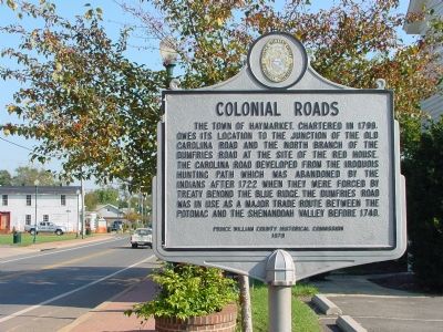
Colonial Roads
Erected 1979 by the Prince William County Historical Commission. (Marker Number 65.)
Topics and series. This historical marker is listed in these topic lists: Colonial Era • Roads & Vehicles. In addition, it is included in the Virginia, Prince William County Historical Commission series list. A significant historical year for this entry is 1799.
Location. 38° 48.753′ N, 77° 38.247′ W. Marker is in Haymarket, Virginia, in Prince William County. Marker is at the intersection of Washington Street (Virginia Route 55) and Fayette Street, on the left when traveling west on Washington Street. Touch for map. Marker is at or near this postal address: 14950 Washington Street, Haymarket VA 20169, United States of America. Touch for directions.
Other nearby markers. At least 5 other markers are within walking distance of this marker. Haymarket During the War (within shouting distance of this marker); a different marker also named Haymarket During the War (within shouting distance of this marker); Haymarket Post Office (within shouting distance of this marker); William Edward Ray, Sr. (about 500 feet away, measured in a direct line); In Memory of the Union Soldiers (approx. 0.2 miles away). Touch for a list and map of all markers in Haymarket.
Related markers. Click here for a list of markers that are related to this marker. To better understand the relationship, study each marker in the order shown.
Also see . . . Town of Haymarket History. (Submitted on December 16, 2006.)

Photographed By Paul Crumlish, August 18, 2009
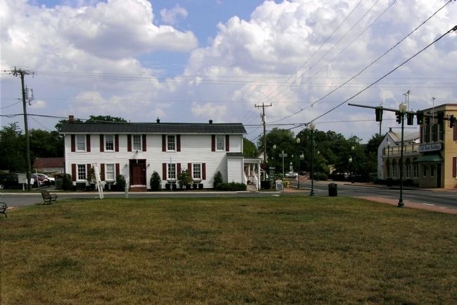
3. Site of the Red House tavern
Located on the NE corner of Jefferson St (Carolina Road) and Washington St (Dumfries Road) in the town of Haymarket, the Red House tavern was built by William Skinker prior to 1780 and was burned by Federal forces on November 5, 1862. The current structure post-dates the Civil War.
Credits. This page was last revised on September 19, 2017. It was originally submitted on December 16, 2006, by J. J. Prats of Powell, Ohio. This page has been viewed 2,372 times since then and 39 times this year. Photos: 1, 2. submitted on December 16, 2006, by J. J. Prats of Powell, Ohio. 3. submitted on August 18, 2009, by PaulwC3 of Northern, Virginia. 4. submitted on June 5, 2007, by Craig Swain of Leesburg, Virginia.
Editor’s want-list for this marker. Historic photo of the Red House • Can you help?


