Near Nelson in Nuckolls County, Nebraska — The American Midwest (Upper Plains)
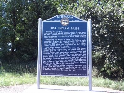
1864 Indian Raids
Beginning on August 7, 1864, the Indians made concerted attacks on stage stations and ranches along the Oregon Trail, hitting nearly every settlement for 400 miles from Julesburg to Big Sandy. Travel ceased for two months.
The most severe attacks were along the upper Little Blue River where about 100 people were killed. Several died at Oak Grove but others escaped and Pawnee Ranch was successfully defended. At "the Narrows" the Eubanks families were attacked and seven killed. Mrs. Eubanks, two children and Miss Laura Roper were taken prisoner and held captive for months. Teamsters were killed, wagon trains burned and ranches were smashed or burned. Settlers fled east to Beatrice and Marysville or northwest to Fort Kearney on the Platte for protection.
Troops and local militia companies attacked and drove back the Indians in the battle of the Little Blue on August 17, 1864. Major raids ceased but skirmishes continued through the fall.
Erected by Civil War Centennial Commission, Historical Land Mark Council. (Marker Number 28.)
Topics and series. This historical marker is listed in these topic lists: Native Americans • Settlements & Settlers • War, US Civil • Wars, US Indian. In addition, it is included in the Nebraska State Historical Society series list. A significant historical year for this entry is 1864.
Location. 40° 19.87′ N, 98° 4.056′ W. Marker is near Nelson, Nebraska, in Nuckolls County. Marker is on State Highway 14, 1.6 miles north of State Highway 4, on the left when traveling north. Touch for map. Marker is in this post office area: Edgar NE 68935, United States of America. Touch for directions.
Other nearby markers. At least 1 other marker is within 16 miles of this marker, measured as the crow flies. The Skirmish at Spring Creek (approx. 15.1 miles away).
Credits. This page was last revised on June 16, 2016. It was originally submitted on August 31, 2014, by Joan Shurtliff of Seward, Nebraska. This page has been viewed 744 times since then and 28 times this year. Photo 1. submitted on August 31, 2014, by Joan Shurtliff of Seward, Nebraska. • Bernard Fisher was the editor who published this page.
Editor’s want-list for this marker. Wide shot of marker and its surroundings. • Can you help?
