San Marcos in Hays County, Texas — The American South (West South Central)
McGehee Crossing

Photographed by Larry D. Moore, May 1, 2020
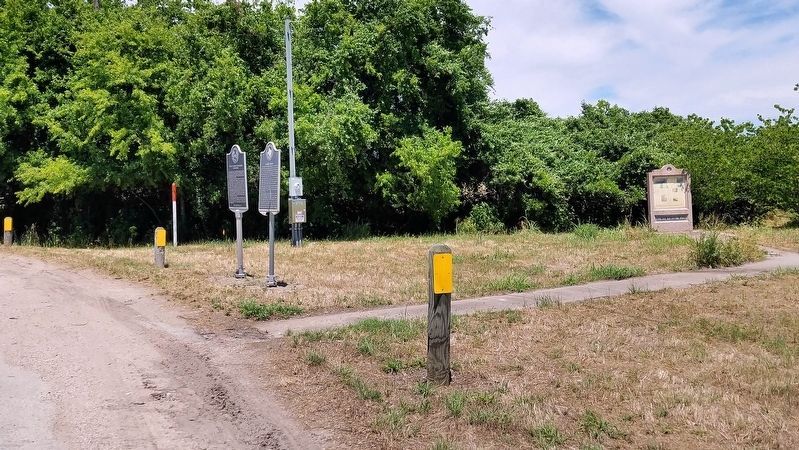
1. McGehee Crossing Marker
The damaged marker has been remounted on a new pole.
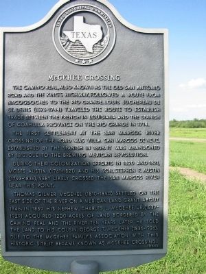
The first settlement at the San Marcos River crossing of the road was Villa San Marcos de Neve, established by the Spanish in 1808. It was abandoned by 1812 due to the brewing Mexican revolution.
During their colonization efforts in 1820 and 1821, Moses Austin (1761-1821) and his son, Stephen F. Austin (1793-1836), very likely crossed the San Marcos River near this point.
Thomas Gilmer McGehee (1810-1890) settled on the east side of the river on a Mexican land grant about 1846. In 1859 his nephew, Charles L. McGehee, Jr. (1837-1929), acquired 1200 acres of land bordered by the Camino Real and the river. Ten years later he sold the land to his cousin, George T. McGehee (1836-1926). Due to the McGehee family's association with this historic site, it became known as McGehee Crossing.
Erected 1987 by Texas Historical Commission. (Marker Number 10293.)
Topics and series. This historical marker is listed in these topic lists: Hispanic Americans • Indigenous Peoples and Communities • Roads & Vehicles • Settlements & Settlers. In addition, it is included in the El Camino Real de los Tejas National Historic Trail series list. A significant historical year for this entry is 1714.
Location. This marker has been replaced by another marker nearby. 29° 52.259′ N, 97° 53.787′ W. Marker is in San Marcos, Texas, in Hays County. It is at the intersection of San Marcos Highway (State Highway 80) and Old Bastrop Road (County Route 266), on the right when traveling west on San Marcos Highway. Touch for map.
this page online

Regionally, this marker is in the Hill Country and in the Austin Metropolitan Area. It is also in the American South. Globally, it is in North America, a Gulf of Mexico state, the Western Hemisphere, the Western World, and the Anglosphere. Historically, it finds itself in what was once New Spain, the Republic of Texas, one of the Confederate States of America, and the Antebellum South.
Other nearby markers. At least 8 other markers are within 2 miles of this location, measured as the crow flies: Cheatham-Hohenberg Cemetery (here, next to this marker); Col. Ignacio Elizondo’s 1813 Campaign (approx. 0.8 miles away); Charles Lewis McGehee Cabin (approx. 1.1 miles away); Site of the First Town of San Marcos (approx. 1.1 miles away); Don Felipe Roque de la Portilla (approx. 1.1 miles away); Lt. Zebulon M. Pike (approx. 1.1 miles away); Thompson's Island Homeplace (approx. 1.9 miles away); Thompson's Islands (approx. 1.9 miles away). Touch for a list and map of all markers in San Marcos.
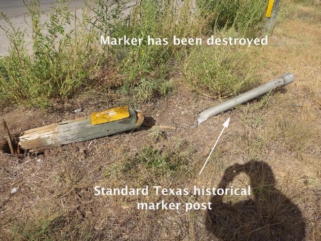
Another marker is no longer
Photographed by Larry D. Moore, May 1, 2020
2. McGehee Crossing Marker Area
Photographed by Jim Evans, September 1, 2014
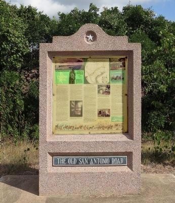
3. Old San Antonio Road Monument
This monument is about 30 feet from where the McGehee Crossing marker once was.
Photographed by Jim Evans, September 1, 2014
4. McGehee Crossing Marker Post
I think this picture is self explanatory.
Photographed by Richard Denney, July 10, 2003
5. McGehee Crossing Marker
Credits. This page was last revised on November 8, 2025. It was originally submitted on October 2, 2013, by Richard Denney of Austin, Texas. This page has been viewed 3,048 times since then and 186 times this year. Last updated on September 5, 2014, by Jim Evans of Houston, Texas. Photos: 1, 2. submitted on May 1, 2020, by Larry D. Moore of Del Valle, Texas. 3, 4. submitted on September 5, 2014, by Jim Evans of Houston, Texas. 5. submitted on October 2, 2013, by Richard Denney of Austin, Texas. • Bernard Fisher was the editor who published this page.
