Harkers Island in Carteret County, North Carolina — The American South (South Atlantic)
Cisterns
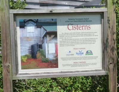
Reducing Stormwater Runoff at the Core Sound Waterfowl Museum
Photographed by Don Morfe, August 15, 2014
1. Cisterns Marker
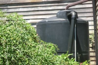
This 1,500-gallon cistern collects stormwater runoff from the roof of the museum. The storm water collected by the cistern is used for general irrigation purposes on site. Storm water controls such as this help prevent fecal coliform and other pollutants from reaching our rivers, creeks and sounds.
Low impact Development (LID) techniques such as this cistern were installed at the Core Sound Waterfowl Museum an Heritage Center and the Cape Lookout National Seashore Visitor Center to reduce the polluted stormwater runoff entering Core Sound. The LID techniques also provide example of cost-effective solutions that can be used to control stormwater on residential properties.
cleanwater Management Trust Fund; Sea Grant North Carolina; NCDENR
Funding for the project was provided by the North Carolina Clean Water Management Trust Fund, by a North Carolina Fishery Resource Grant administrated by North Carolina Sea Grant and by the N.C. Department of Environment and Natural Resources’ Division of Soil and Water Conservation’s Community Conservation Assistance Program.
Project Partners
Core Sound Waterfowl Museum and Heritage Center, Cape Lookout National Seashore, N.C. State University’s Department of Biological and Agricultural Engineering, Master Gardener Volunteers of N.C. State University’s Cooperative Extension, North Carolina Coastal Federation.
Erected by cleanwater
this page online
Topics. This historical marker is listed in these topic lists: Environment • Man-Made Features.
Location. 34° 41.234′ N, 76° 31.726′ W. Marker is on Harkers Island, North Carolina, in Carteret County. It can be reached from the intersection of Cape Point Drive and Island Road (County Route 1335), on the right when traveling south. The marker is on the grounds of the Core Sound Waterfowl Museum and Heritage Center. Touch for map. Marker is at or near this postal address: 1785 Island Road, Harkers Island NC 28531, United States of America. Touch for directions.

Regionally, this marker is in the Coastal Plain and on the Crystal Coast. It is also in the American South, specifically in the Upper South, in the Tidewater, and on the Eastern Seaboard. Globally, it is in the North Atlantic Region, North America, the Western Hemisphere, the Western World, and the Anglosphere. Historically, it finds itself in what was once the territory of the Mississippian Culture, one of the original Thirteen Colonies, one of the Confederate
Photographed by Don Morfe, August 15, 2014
2. Cisterns
Other nearby markers. At least 8 other markers are within 2 miles of this marker, measured as the crow flies: Rain Gardens (within shouting distance of this marker); Harkers Island Visitor Center at Cape Lookout National Seashore (approx. 0.2 miles away); Fort Hancock (approx. 0.2 miles away); Olive Thurlow Anchor (approx. 0.2 miles away); Protecting People and Ships (approx. 0.2 miles away); Estuaries of the Sound (approx. 0.2 miles away); Horizon of Islands (approx. 0.2 miles away); In Honor and Rememberance (approx. 1.4 miles away). Touch for a list and map of all markers in Harkers Island.
Another marker is no longer nearby. Cape Lookout Lighthouse (was approx. 0.2 miles away but has been confirmed missing).
Also see . . . Core Sound Waterfowl Museum & Heritage Center. (Submitted on September 16, 2014.)
Photographed by Don Morfe, August 15, 2014
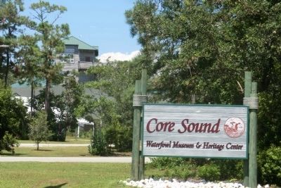
3. Core Sound Waterfowl Museum & Heritage Center-Entrance Sign
Photographed by Don Morfe, August 15, 2014
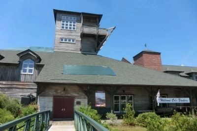
4. Core Sound Waterfowl Museum & Heritage Center
Credits. This page was last revised on June 16, 2016. It was originally submitted on September 10, 2014, by Don Morfe of Baltimore, Maryland. This page has been viewed 479 times since then and 19 times this year. Photos: 1, 2, 3, 4. submitted on September 10, 2014, by Don Morfe of Baltimore, Maryland. • Bernard Fisher was the editor who published this page.
